Kramatorsk
Kramatorsk [Краматорськ; Kramators'k]. Map: V-18, DB Map: DBII-3. City (2020 pop 152,100) in the northern part of Donetsk oblast, situated on the Kazennyi Torets River, a tributary of the Donets River. It is one of the largest centers of the heavy machine-building industry in Ukraine and an important transportation node, on a major railway trunk line (double tracked, electrified) linking cities from the south and east of the Donets Basin to the north and west. The population of Greater Kramatorsk (the Kramatorsk City Council, which includes 9 nearby towns) in 2020 was 185,100. Together with the urban clusters at Sloviansk (133,000) to its immediate north and at Druzhkivka (65,100) and Kostiantynivka (70,000) to its immediate south, it forms an elongated conurbation of 453,200. Since the occupation of Donetsk by pro-Russian forces in 2014, Kramatorsk serves as the provisional Ukrainian administrative center of Donetsk oblast.
History. Kramatorsk arose in the second half of the 19th century, when a station of the Kursk–Azov railway was established (called Kram-na-Tore in 1868, later conflated into Kramatorsk) next to the village Petrivka (established in 1767 by Count F. Taranov) and the town grew up around it. Over time, other settlements of Ukrainian peasantry (Abazovka, Ivanivka, Shabelkivka, and Shteiherovka), established by gentry in the late 18th century on the lands of the Oril palanka of the liquidated (in 1775) Zaporozhian Sich, were incorporated into the new town. The discovery of chalk, sand, sandstone, valuable clays and mineral dyes nearby led to the construction of a building materials factory in 1885. The town grew as the Donets Basin developed. In 1896 a German firm opened a factory to produce machinery for the mining and railway industries (now the Old Kramatorsk Machine-Building Plant) and its associated metallurgical plant (now the Kramatorsk Metallurgical Plant). By 1914 the town had 4,000 inhabitants.
During Ukraine’s struggle for independence (1917–20), Kramatorsk was under the control of the Ukrainian National Republic from April to December, 1918, then taken by Bolsheviks and held until May 1919, when it was captured by the ‘White’ Cossacks of the Volunteer Army, and then re-captured by the Red Army in December 1919 and incorporated into the Ukrainian SSR as part of Donetsk gubernia (1920–25) and then Artemivsk (Bakhmut) okruha (1925–30).
With renewed industrialization, the population of Kramatorsk grew to 12,000 in 1926. Its ethnic make-up was 55.4 percent Ukrainian, 35.3 percent Russian, 2.4 percent Belarusians, 1.8 percent Germans, 1.4 percent Poles, and 1.1 percent Jews.
Accelerated industrialization in the 1930s brought rapid urban growth. Kramatorsk became a city (1932), expanded its metallurgical plant and opened a second, larger New Kramatorsk Machine-Building Plant (1934). During the Second World War Kramatorsk was occupied by the German forces from 27 October 1941 to 5 February 1943, and again from 27 February to 6 September 1943, when it was re-captured by the Soviet Army. Its population, having reached 93,000 in 1939, recovered after the war to 115,000 in 1959, 150,000 in 1970, 178,000 in 1970, and 201,000 in 1991, peaked at 204,000 in 1993, and began to decline thereafter.
After Ukraine’s independence, Ukrainian identity was no longer an issue but the loss of Ukrainian language to Russian was indicative. According to the 2001 population census, Greater Kramatorsk had 216,200 residents, of whom, by ethnicity, there were 70.2 percent Ukrainians, 26.9 percent Russians, 0.7 percent Belarusians, 0.6 percent Armenians, 0.2 percent Azeri, and 0.1 percent Jews. As for their mother tongue, only 31.1 percent of all residents identified it as Ukrainian and 67.9 percent as Russian; minority mother tongues included 0.2 percent Armenian, and 0.1 percent Belarusian.
With the outbreak of hostilities in 2014, from May 12 until July 5 the city was occupied by the Russia-led fighters of the so-called ‘Donetsk People’s Republic’ (DPR). In the course of the battles some factories were partially destroyed and 50 people were killed. Following the city’s liberation but the loss of Donetsk to the DPR, Kramatorsk became the provisional administrative center of Donetsk oblast (October 2014) and of the Donetsk Appeals Court (November 2014). On 10 February 2015, before the DPR Debaltseve offensive, Kramatorsk was hit with Russian ‘Smerch’ missiles launched from occupied Horlivka, resulting in 17 dead and 64 injured. At the beginning of 2016 a relief center in Kramatorsk was established for the aged refugees from occupied territories to assist them obtain pensions, social and medical services. The names of its streets were de-Communized in 2016.
Economy. Kramatorsk developed as a machine-building center of the Donets Basin, with a focus on heavy machine-building for metallurgy, coal mining, transport and energy generating industries. After Ukraine’s independence, enterprises were privatized, modernized and diversified. Other industries provided subsidiary functions, as did services for the population. Moreover, Kramatorsk gained the administrative function of Donetsk oblast in 2014 and of the newly-formed Kramatorsk raion in 2020.
Kramatorsk has 9 machine-building enterprises: 1) the Old Kramatorsk Machine-Building Plant (established in 1896, nationalized in 1920, began making tubes in 1991, privatized in 1995, developed a tank gun in 2019); 2) the New Kramatorsk Machine-Building Plant (established in 1934, now a share-holding company, makes metallurgical equipment, lifts for mines, mining and enrichment machines, employed 13,500 workers in 2012); 3) the Kramatorsk Heavy Duty Machine Tool Building Plant (established in 1937, maker of lathes and milling machines, used for finishing railway wheels; privatized into a joint-stock company in 1995, contracted to make tank and artillery gun barrels since 2011, partly destroyed in 2014); 4) Kramatorsk Metal Construction Plant (established in 1965, privatized in 1994, makes metal structures and conduits); 5) ‘KramTechCenter’ (established in 2000, maker of metal constructions and conveyers); 6) the Kramatorsk Energy Machine Building Plant (established in 2012, produces and supplies equipment and spare parts for power and mining industries, partly destroyed in 2014); 7) the ‘Konditsioner’ Kramatorsk Plant (established in 1976, privatized in 1995, makes compressors and air conditioners for offices and vehicles); 8) the Autogenous Welding Equipment Plant ‘Donmet’ (established in 1990, privatized in 1999, makes all kinds of equipment to gage and deliver oxygen in medical applications, as well as for welding and cutting torches); 9) Fuhrländer Windtechnology (established in 2010, builds wind generating equipment and puts wind parks in operation).
Its 3 supporting metallurgical enterprises are: 1) the Kramatorsk Metal Rolling Plant; 2) the Kramatorsk Ferroalloy Plant (both are based on the bankrupt Kramatorsk Metallurgical Plant, which was established in 1896, nationalized in 1920, expanded in 1950, privatized in 1994, was bankrupt and reorganized in 2012; one makes pig iron and rolled steel, the other, ferrous alloys); and 3) the ‘EnergMashSpetsStal,’ (established as a casting and forging plant in 1962, added electric smelter in 1970, and vacuum induction smelter in 1978, privatized in 1995, makes high quality metal parts, like the retention walls for a nuclear power plant made on contract for Thyssenkrupp, France, in 2010).
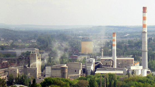
The building materials industry is represented by: the Kramatorsk Slate Plant (‘Kramatorskyi Shyfer’) (the original plant dates back to 1885, renewed in 1923, combined with cement plant in 1972, separated and privatized in 1995, new ownership and current name since 2004; makes building materials such as flat slate, 8-wave slate, slate color, pigmentation slate, asbestos-cement pipes and fittings); the Kramatorsk Cement Plant ‘Pushka’ (the original cement plant established by a Belgian company in 1912, later expanded and modernized, and in 1972 combined with slate plant into one complex, separated and privatized in 1995; it makes various grades of Portland cement, and slag concrete frames, plates and asbestos-cement sheets for panel home construction); the Kramatorsk Enamel Plant (established in 2001), and the Kramatorsk Asphalt Plant (established in 2017). Also made in Kramatorsk are electric lamps and ceramic insulators.
Food processing includes a meat processing plant (notably sausages), a grain mill, a brewery, and food preparation and catering for schools (established in 1998). A feed mill serves the agricultural livestock sector in the area. The light industry is represented by the ‘Shveia’ sowing plant (established in 1936). Carton making, packaging, wood-working, furniture-making, and printing plants also serve both industry and consumers. Auto repair enterprises serve the needs in the city and vicinity.
An information technology company, ‘QuartSoft Corp.’, was founded in Kramatorsk in 1999; now it has offices in the United States and Austria.
Culture and education. In the Soviet period educational and cultural institutions focused on supporting industrial development. A branch of the Scientific-Research and Technological-Planning Institute of Machine Building was located in Kramatorsk. Local cadres were trained in the Kramatorsk Machine-Building Tekhnikum (established in 1937) and higher qualifications were pursued in the Kramatorsk branch of the Donetsk Industrial Institute (established in 1952, becoming the Kramatorsk Industrial Institute in 1960, expanded from 1963 to 1978), while 7 vocational-technical schools offered training in skilled trades. A historical-revolutionary museum and a museum of fine arts provided the social content. Physical fitness and esprit de corps were cultivated with the provision of athletic facilities for sports, and summer camps for youth.
With Ukraine’s independence the existing educational institutions broadened their curricula: the Kramatorsk Industrial Institute was re-named the Donbas State Machine-Building Academy in 1994, while the Kramatorsk Machine-Building Tekhnikum gained status of a college in 1991, and then became part of the Donbas State Machine-Building Academy in 1997. Two new institutions were established: the Kramatorsk Institute of Economics and the Humanities (started locally in 1992, accredited in 1998), and the Donbas Institute of Technology and Management of the International Scientific-Technological University named after Academician Yurii Buhai (began as an affiliate of Kyiv scientific-research institutions in 1995, accredited internationally in 2013). Three other universities relocated entirely or in part to Kramatorsk following the hostilities of 2014: the Donbas National Academy of Building and Architecture (from Makiivka; established in 1972 as the Makiivka Engineering-Building Institute, re-named the Donbas Engineering-Building Institute in 1993, awarded status of academy and re-named Donbas State Academy of Building and Architecture in 1994, awarded status of a national institution of higher learning and assumed current name in 2004, relocated to Kramatorsk in 2014); a branch of the Donetsk National Medical University (from Donetsk); and the Trade College of the Donetsk National University of Economics and Trade (from Donetsk).
In addition to its historical and fine arts museums, Kramatorsk has three schools of fine arts, 23 libraries, and 16 clubs and palaces of culture (including a flying club [now closed], technology club, a center for extracurricular learning, and a private observatory).
Local weekly newspapers are published in Russian: Kramatorskaia Pravda (since 1930, organ of the city council), Gazeta Tekhnopolis, Gazeta Privet, and Vostochnyi Proekt: Novosti Kramatorska. There is a television station, cable and digital TV. Radio offers 18 FM stations.
Sports and recreational facilities are well developed. There are the Blooming Stadium (built in 1937, re-built in 1956, seats 10,000, belongs to the New Kramatorsk Machine-Building Plant, home of the FC Avanhard Kramatorsk in the First Football League of Ukraine), and the Prapor Stadium (formerly the Avanhard Stadium [2011–17], built in 1936, seats 6,000, owned by the Old Kramatorsk Machine-Building Plant). There are three large city parks: 1) the Bernatsky Park (37 ha, with the Prapor Stadium), 2) the Aleksandr Pushkin Park (41 ha, with the Blooming Stadium), and 3) the Jubilee Park (a 110 ha multi-purpose area with green space, pond, playground with rides, and facilities for sports and extracurricular activities).
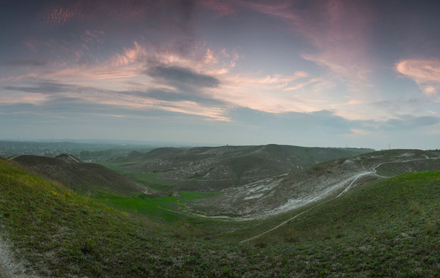
The Kramatorsk Regional Landscape Park (1,739 ha), established in 2004 within the Greater Kramatorsk city limits, provides appreciation and protection of nature. It consists of four parcels: 1) the Bilenke Parcel (478 ha in the town of Bilenke north of Kramatorsk, on the northern slopes of Bilenka River [right tributary of the Kazennyi Torets River], exposed chalk deposits that host relict steppe vegetation); 2) the Pcholkin Petrified Forest (south of Kramatorsk and east of Krasnotorka, 23 ha of planted pines among outcrops of petrified trees from the Carboniferous Period over 200 million years old); 3) the Komyshuvakha Parcel (southwest of Kramatorsk, on the west side of Komyshuvakha, 865 ha of deciduous forest and wildlife in deep ravines, with its Swan Lake and remains of the 18th century Bantishev Estate); and 4) the Bilokuzmyniv Parcel (southeast of Kramatorsk and east of the village of Semenivka, 374 ha of chalk exposure in unoccupied steppe with its natural vegetation).
Public worship also revived since 1991 and new churches were built by parishioners. Of the churches listed, 7 belonged to the Ukrainian Orthodox Church-Moscow Patriarchate, 1 to the Orthodox Church of Ukraine, 2 to Ukrainian Catholic church, and 1 to Roman Catholic church (serving mainly the Polish community); other categories mentioned but not enumerated were Baptists, Protestants, and other religions and sects.
City plan. Greater Kramatorsk occupies 356 sq km of urban and outlying rural areas to the east and west. It abuts Sloviansk to the north and Druzhkivka to the south, with the city of Kramatorsk in the middle and a cluster of 9 towns around it: from northeast to south, in an anticlockwise direction, Bilenke (9,400), Yasnohirka (8,000), Yasna Poliana (2,200), Shabelkivka (4,200), Oleksandrivka (400), Sofiivka (900), Krasnotorka (2,900), and then to the southwest, Malotaranivka (3,800), and Komyshuvakha (500). The city of Kramatorsk occupies 77.36 sq km (or 21.7 percent of the area of Greater Kramatorsk).
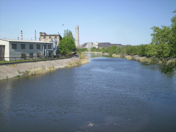
The layout of Kramatorsk reflects the history of its growth. Central to Kramatorsk is a broad, J-shaped industrial belt of factories and rail spurs that grew from the Kramatorsk railway station northward along the Kazennyi Torets River to the present northern city limits. The stem of this imaginary J is bound in the west by the railway trunk line and in the east by the main north-south thoroughfare. The bottom of the J rests on the east-west thoroughfare. The bottom left tip of the J crosses west of the trunk line, where the Kramatorsk Slate Plant and the Kramatorsk Cement Plant ‘Pushka’ are located; north of these plants, beyond Yasna Poliana and westward are their clay, chalk and ochre excavations. At the southern tip of J, east of the Kramatorsk station, is the Old Kramatorsk Machine-Building Plant. To the north of it, in succession, are: the Kramatorsk Metal Rolling Plant with its blast furnaces and slag heap, and the Kramatorsk Ferroalloy Plant; the Kramatorsk Metallurgical Plant and east of it a number of smaller plants, including the experimental plant of the Scientific-Research and Technological-Planning Institute of Machine Building; the New Kramatorsk Machine-Building Plant and the Kramatorsk Thermal-Electric Power Station; the Kramatorsk Heavy Duty Machine Tool Building Plant; the Kramatorsk Metal Construction Plant; and the ‘EnergMashSpetsStal.’ Elsewhere in the city are a number of other industrial plants.
Kramatorsk has two city centers, located on either side of its industrial belt. The old and the new city centers are linked by a multi-use corridor and a node of services.
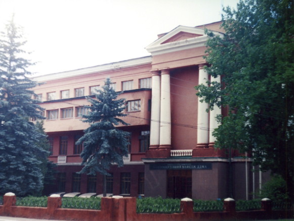
The old city center is located just west of the Kramatorsk railway station, and borders on the slate and cement plants. The street layout of the old city center is an irregular grid forming an elongated rectangle about 1 sq km. The old city center has a Memorial Square and the adjacent Leonid Bykov Culture Center, a park-like Metallurgist Square with playground and coffee shop, two markets, two clinics, the Kramatorsk Machine-Building College of the Donbas State Machine-Building Academy, a former palace of culture for cement workers, converted to the Christian Church ‘New Life,’ and the Holy Protectress Ukrainian Orthodox Church (Moscow Patriarchate). Its main east-west thoroughfare (School Street) leads east to a bridge over the trunk line to the Konrad Hamper Street. This forms a corridor past the Old Kramatorsk Machine-Building Plant and across the Kazennyi Torets River along Old Petrivka to the north and Bernadsky Park with the Prapor Stadium and other sports facilities to the south, reaching the main intersection with the north-south thoroughfare: the Oleksa Tykhy Street. At its northeast quadrant, a block of apartment buildings forms a node that includes the central city hospital and the city’s natality center. A public library is nearby.
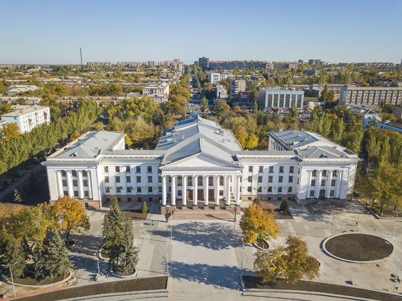
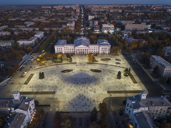
The new city center begins 1 km northeast of this intersection, along Oleksa Tykhy Street, on the east side (away from the mills and smelters) and beyond its green buffer zone (70 ha of mostly natural parkland). The center is laid out in a large square grid pattern, covering over 6 sq km. Its southern limit includes Jubilee Park; its northern limit reaches beyond Aleksandr Pushkin Park to the Rumiantsev Street. In the east multi-story apartment buildings extend to the end of the built-up areas along Kramatorsk Boulevard. The central axis of the new city center, oriented from northwest to southeast, features Peace Square and the New Kramatorsk Machine-Building Plant Palace of Culture in the middle, with Peaсe Avenue extending to the northwest and Palace Street to the southeast.
Peace Avenue serves as the grand entrance to the center. It begins at the gates of the New Kramatorsk Machine-Building Plant, leads from the Oleksa Tykhy Street, passes through the green buffer, across the Machine-Builder’s Boulevard, then forms a park boulevard containing a memorial to the fallen soldiers in Afghanistan, and widens again to encompass the Peace Square and palace of culture, beyond which both lanes end at the central cross arterial, Vasyl Stus Street. From the Vasyl Stus Street, aligned with the palace of culture, the Palace Street continues to the southwest. On the south side of Peace Square is the Kramatorsk City Hall and a small Taras Shevchenko Park; on the north side, the Professional Unions Square with its park and fountain. Two blocks east of this square there is a second memorial esplanade bound by the Heroes of Ukraine Street, containing an eternal flame, a mass grave memorial to the Red Army soldiers and a memorial to the victims of the bombardment of Kramatorsk in 2015.
Located in the new city center are the court house, police stations, the main post office and international telephone service, two markets, many stores, two hotels, a travel agency, two hospitals and many clinics. Most of the pre-2014 postsecondary institutions are located along the south end of the Machine-Builder’s Boulevard (the Donbas Institute of Technology and Management; the Donbas State Machine-Building Academy; the Kramatorsk Institute of Economics and Humanities; the Tekhnikum of the Donetsk State University of Economics and Trade; and the Technological Tekhnikum). There is the central library, the children’s library, city archives, two museums, and two other cultural centers.
In the post-Soviet period several churches were built here, including the Holy Trinity Cathedral in the Jubilee Park. Since 2014 the new city center of Kramatorsk became host to the Donbas National Academy of Building and Architecture; a branch of the Donetsk National Medical University; and the Trade College of the Donetsk National University of Economics and Trade. It now also houses the offices of the Donetsk Oblast Administration, and the Donetsk Oblast Appeals Court. The office of the Kramatorsk Raion Administration (formed in 2020) has yet to be established.
Kramatorsk is served by a public transit system. Street cars operated since 1937; the last three routes were finally closed in August 2017. Trolley busses continue to operate since their introduction in 1971 on 10 regular and 3 reserve routes. There are 32 bus routes. Trains also provide commuter service, with 6 stops on the territory of Kramatorsk. Inter-city passenger service is provided by trains and buses.
Kramatorsk has a military airport with a long runway, located southwest of the city. It also hosted a flying club. It was a strategic objective in 2014 and again targeted in 2015.
BIBLIOGRAPHY
‘Kramators'k’ in Heohrafichna entsyklopediia Ukrainy (Kyiv 1990)
‘Kramatorsk: Plan goroda’ 1:15,000 in Mista Ukrainy (Kyiv 2002)
‘Kramators'k: Plan mista’ 1:18,000 in Mista Ukrainy (Kyiv 2013)
Karta Kramators'ka, Donets'koi oblasti (2020): https://kartaukrainy.com.ua/Kramatorsk
Ihor Stebelsky
[This article was updated in 2021.]
.jpg)
