Valleys
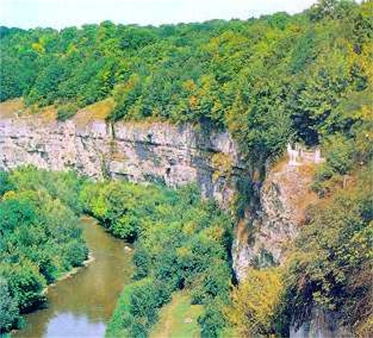
Valleys (долини; dolyny). Linear-shaped areas of lower elevation on the surface of the earth commonly formed by the erosive action of flowing water. All valleys consist of slopes (along the sides) and a bottom. In Ukraine valley slopes typically are asymmetrical, often with a high right bank and a low left bank. The asymmetry can be attributed to the endogenic processes and the lithology of parent material, while the manner of the erosion and aggradation of the country's rivers have resulted from fluctuations in the level of the Black Sea and changes in climate.
River valleys in Ukraine are usually classified into three types, lowland (which constitute an overwhelming majority), mountain, and submontane (as in the Dnister Basin). The number of their terraces varies not only from one river valley to another but also within the same river valley. Lowland river valleys predominantly contain aggradational type terraces consisting of fine particles (usually sand). Such terraces are also found in the submontane valleys, together with erosive-aggradational types made up of water-sorted gravels. The erosive terraces (including boulder pavements and rock sculpting) prevail in the mountain valleys.
The river valleys of Ukraine evolved in several geomorphological stages. Broad river valleys with large floodplains were formed at the end of the Pliocene epoch, when the Black Sea stood approx 50 m above its present level. Their remnants may still be seen in the form of broad terraces along the left bank of the Dnipro River as well as in the Donets River, the Dnister River, and the Prut River valleys.
Intensified or rejuvenated river erosion in the early Pleistocene epoch, caused by a drop in the landlocked sea (80–100 m below the present level) resulting from neotectonic uplift, deepened valleys and sculpted landforms. The submarine valleys of the old Dnipro River, Dnister River, and Danube River were created in consequence. The valleys may still be detected on the shelf bottom of the Black Sea, but their surfaces have been modified by subsequent marine deposits. Climatic cooling in the Dnipro age of the Pleistocene brought on the maximum extent of continental glaciation, in which the ice cap depressed the landmass and caused the Black Sea to rise 20 m above its present level. Its rising provided conditions for the formation of liman valleys along the coast. As well, meltwaters from the ice cap produced ponding, with excess water that either spilled over the low points of divides or flowed along the ice margin into valleys that channeled it toward the Black Sea. Glacial spillways were thereby created, some of which still serve as parts of existing river valleys, and others of which have become dry. Examples include the spillways between the Styr River and the Slovechna River (over 400 km) and between the Sian River and the Dnister, and the shorter but more numerous spillways that cross the Dnipro Upland from north to south or connect the left-bank tributaries of the Dnipro. The subsequent isostatic recovery of the landmass and the adjustment of the Black Sea to the present level rejuvenated erosive forces. River channels cut deeper valleys and left remnants of the Pleistocene alluvial deposits visible as terraces. Former river channels of the Pleistocene Dnipro delta dried up to form some of the depressions known as pody.
BIBLIOGRAPHY
Gerenchuk, K. Tektonicheskie zakonomernosti v orografii i rechnoi seti Russkoi ravniny (Lviv 1960)
Tsys’, P. Heomorfolohiia URSR (Lviv 1962)
Sokolovs’kyi, I. Zakonomirnosti rozvytku rel’iefu Ukraïny (Kyiv 1973)
Ihor Stebelsky
[This article originally appeared in the Encyclopedia of Ukraine, vol. 5 (1993).]

