Oskil River
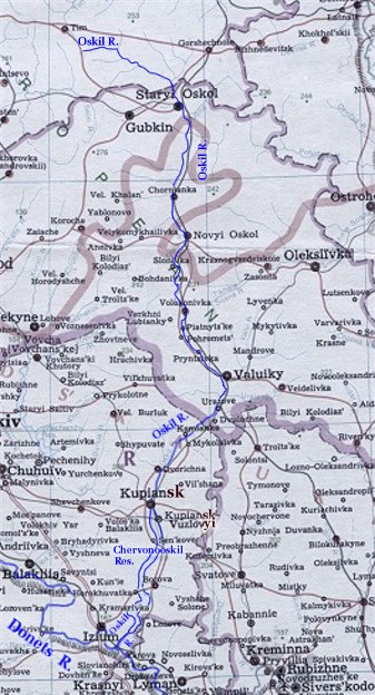
Oskil River (also Oskol). (Map: Oskil River.) A left-bank tributary of the Donets River. It is 472 km long and drains a basin area of 14,800 sq km. The river flows through Kursk oblast and Belgorod oblast in the Russian Federation before running southward across the eastern end of Kharkiv oblast. It is generally 30–40 m wide and 2.5–3 m deep (maximum depth, approx 10 m). It is fed largely by meltwater and is frozen from November to March. A hydroelectric station is located on the lower course of the river together with the artificial lake, Chervonooskil Reservoir, created by the station. The largest Ukrainian center located along the river is the city of Kupiansk.
[This article originally appeared in the Encyclopedia of Ukraine, vol. 3 (1993).]

