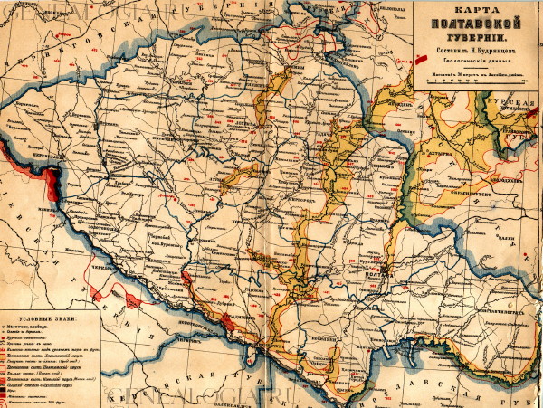
Poltava gubernia
Poltava gubernia [Полтавська губерня; Poltavska hubernia]. An administrative-territorial unit created in Russian-ruled Left-Bank Ukraine in 1802 after the abolition of Little Russia gubernia. Its territory (45,894 sq km) was subdivided into 15 counties: Hadiach, Khorol, Kobeliaky, Kostiantynohrad, Kremenchuk, Lokhvytsia, Lubny, Myrhorod, Pereiaslav, Pyriatyn, Poltava, Pryluky, Romny, Zinkiv, Poltava gubernia, and Zolotonosha. The capital was Poltava. In 1803 the gubernia had 1,343,000 inhabitants. A predominantly agricultural, economically backward region, 90 percent of its 2,778,151 inhabitants were peasants in 1897 and 93.6 percent were Ukrainian. The main ethnic minorities were Jews (3.7 percent), Russians (2.4 percent), and Germans (0.7 percent). The gubernia's main commercial centers were Poltava, Kremenchuk, and Romny. The major nonagrarian occupations were brewing, distilling, wine making, flour milling, lumber milling, sugar refining, and tobacco processing. Because of rural poverty, nearly 200,000 peasants emigrated from the gubernia to Siberia and the Far East in the years 1906–12. As a result of the deaths and emigration that occurred during the First World War and Ukrainian-Soviet War, 1917–21, and the transfer of Pereiaslav county to Kyiv gubernia in 1920, the gubernia's population dropped from 3,792,100 (only 10.6 percent urban) in early 1914 to 3,566,800 in 1924. In 1924, only 12 percent of the population was urban; 68 percent of the urban population was Ukrainian, 25 percent was Jewish, and 5 percent was Russian. That year the counties were replaced by the seven okruhas of Krasnohrad (formerly Kostiantynohrad), Kremenchuk, Lubny, Poltava, Pryluky, Romny, and Zolotonosha, and in 1925 the gubernia was abolished.
[This article originally appeared in the Encyclopedia of Ukraine, vol. 4 (1993).]

