Stavropol region
Stavropol region. A historical-geographic region in the Russian Federation located in the central part of Subcaucasia, between the Kuban River (and Kuban region) to the west, the Terek region to the southeast, the Don region to the north, the Kalmyk Autonomous Republic to the northeast, and the lands of the Caucasian mountain peoples to the south and southwest. The Stavropol region essentially corresponds in territory to the former Stavropol gubernia (within its 1861–1920 boundary, 59,500 sq km) and the later Stavropol krai, less the Karachai-Cherkess Autonomous oblast (66,500 sq km). Until the 1930s the Stavropol region was settled by both Ukrainians and Russians, and constituted a part of contiguous, albeit mixed, Ukrainian ethnographic territory.
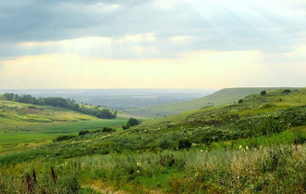
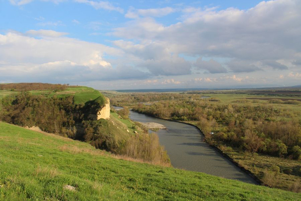
Physical geography. The major portion of the Stavropol region is occupied by the Stavropol Upland; the minor portion has parts of the Caspian Lowland in the east, the Kuma-Manych Depression in the north, and the foothills of the Caucasus Mountains in the southwest. The climate of the Stavropol region is transitional, from temperate continental in the west to drier and more continental in the east. The rivers in the region belong to the Sea of Azov and the Caspian Sea drainage basins. The larger ones include the Yegorlyk (which flows into the Manych), the Kalaus, the Kuma, and the Kuban and its upper tributaries, the Velykyi Zelenchuk and the Malyi Zelenchuk (see Zelenchuk rivers). River water is used for irrigation. Small, mostly saline lakes abound; the largest is the narrow but 160-km-long Lake Manych-Gudilo (Ukrainian: Manych-Hudylo).
The soils in the western and central part of the Stavropol region are various chernozems and chestnut soils; to the east and northeast they become light chestnut. The natural vegetation also changes eastward with declining humidity, from meadow fescue–feather grass steppe to dry fescue–feather grass steppe and then semidesert vegetation of wormwood, dry fescue, and feather grass. In the more humid part of the Stavropol Upland and in the Caucasus foothills the natural vegetation is forest-steppe with oak-hornbeam-beech forests. Today both the steppe and the forest-steppe are almost completely cleared for agriculture.
History. In the mid-16th century the Caucasus and the Stavropol region began to come into contact with Muscovite colonization. In the 16th and 17th centuries Subcaucasia experienced the beginnings of Cossack colonization (the Don Cossacks in the west and the Terek Cossacks in the east). Nevertheless the centrally located Stavropol region remained sparsely inhabited by the nomadic Nogay Tatars (a Turkic-speaking people) and Kalmyk people (a Mongol-speaking group), who together numbered about 80,000. Caucasian mountain peoples, the Karachai and the Cherkess, lived in the foothills of the region.
At the beginning of the 18th century the Stavropol region nominally became part of the Russian Empire. Permanent settlements, however, were not established until the last quarter of the century, when, in 1777–80, the Russian government built a line of forts, the Mozdok-Azov line, with headquarters at Stavropol, to contain the Caucasian mountain peoples. By 1785 the Stavropol region formed part of Caucasus oblast, which was redesignated a gubernia in 1802. Following several name changes it was designated as Stavropol gubernia in 1847. Its boundaries were finally fixed in 1861, when it was separated from Terek oblast. In contrast to Kuban oblast and Terek oblast, Stavropol gubernia (since 1898) was not part of Caucasus krai.
The Russian government promoted the rapid colonization of the Stavropol region in order to establish a base for military campaigns in the Caucasus. Part of that aim was achieved by the granting of choice tracts of land to Russian noblemen, who settled them with their serfs. A more significant factor in colonization, however, was the spontaneous settlement by state peasants who were unimpeded by the central authorities. In fact the imperial government legalized extant claims with the ukase of 1804 and provided support to those who had settled in the Stavropol region. By the end of the 1850s the population of Stavropol gubernia had increased to 340,000 (5.5 persons per sq km). Its only city, Stavropol, grew from about 3,000 residents in 1800 to 17,600 residents in 1853. The most densely settled areas were the steppes between the Yegorlyk and the Kalaus rivers and the Kalaus River valley. The population of Stavropol gubernia (together with Terek oblast) in 1853 consisted of 48.7 percent Cossacks, 32 percent state peasants, 16.2 percent nomadic herders, and 3.1 percent serfs and others.
The region's population continued to grow after the abolition of serfdom in 1862 with the arrival of immigrants from Ukraine, particularly Left-Bank Ukraine and Katerynoslav gubernia. They were soon joined by settlers from the mixed Russian-Ukrainian gubernias of Voronezh and Kursk and then from the predominantly Russian Orel gubernia. By the beginning of the 20th century Ukrainians constituted 49.5 percent of all the immigrants to the Stavropol region, and Russians made up 36.6 percent. Stavropol gubernia's population had grown from 340,000 in 1867 to 873,000 by 1897 and to 1,150,000 by 1914. According to the 1897 census 9 percent of the population was urban. The ethnic composition was recorded as 55.3 percent Russian; Ukrainians constituted 36.6 percent of the total population and 39.9 percent of the rural population. The remaining 8.1 percent were mostly the pastoral Nogay, Kalmyk, and other Turkic peoples, who had been relegated to the dry eastern and northeastern steppes.
As the population grew, the area under the plow increased even faster, with the three-field system of cropping becoming a norm. The export of foodstuffs was facilitated by the construction of the railroads, notably the main line from Moscow through Rostov and Vladikavkaz to Baku (1875), a branch line from Kavkazskaia (renamed Kropotkin in 1921) to Stavropol (1897), and another from Pelagiada to Vinodelnoe (1916). Industry was poorly developed, and consisted almost exclusively of food processing.
During the civil war that followed the Revolution of 1917 the Stavropol region remained politically passive. Nevertheless, from the end of 1917 until the beginning of 1920, the region served as a battleground for Bolshevik and White forces. In January 1918 the Stavropol Soviet Republic was established as part of the Russian Soviet Federated Socialist Republic; from mid-1918 until the beginning of 1920 the Stavropol region was held by the Whites. The region finally was taken as a Soviet possession and became part of a large territorial-administrative region called North Caucasian krai. In 1924–30 the krai was subdivided into okrugs, and the former Stavropol gubernia became Stavropol okrug and parts of Terek, Armavir, and Salske okrugs. In 1937–43 the Stavropol region was the principal part of Ordzhonikidze krai, and in 1943 Stavropol krai was formed, to which the Karachai-Cherkess Autonomous oblast was added as a subordinate part. After the Second World War the Stavropol region developed along much the same lines as other areas of the Soviet Union in general and the RSFSR in particular. A notable development was the rise to political prominence of one of the region's native sons, Mikhail Gorbachev, who became the last leader of the USSR.
Population. After major population losses in 1917–20 and during the famine of 1922–3, the Stavropol region surpassed the prewar (1914) 1.15-million mark only in 1926 with a population of 1.2 million. The urban population, according to the 1926 census, remained at 8 percent; ethnic composition changed little, but there was a slight increase in the proportion of Ukrainians and a decline in the share of the non-Slavic (other) population (see table 1). Among the other nationalities there were 21,000 Germans, 7,000 Armenians, and 3,000 Greeks. The distribution of Ukrainian settlement was uneven. Their lowest shares (5–10 percent) occurred in the southwestern part of the region along the line of former forts where the Don Cossacks, the Volga Cossacks and other Russian servitors were settled in the 18th century. Their largest presence, in the northeastern part, was established largely in the second half of the 19th century, when Ukrainian immigration was prevalent. The main basis for population growth in the early 20th century was natural increase, for immigration scarcely exceeded emigration. Among the immigrants, according to the 1926 census, the majority came from Ukrainian lands.
Demographic changes after 1926 in the Stavropol region indicated trends that were similar to though less pronounced than those in other Ukrainian regions: an average population growth until 1931 and in the period 1935–40 (reduced from high growth by the arrest of kulaks and by political purges), a decline during the man-made famine of 1932–3 and the hostilities of 1942–5, and revived growth after 1945. The share of urban population grew continuously (see table 2).
Recent population growth has continued to be driven primarily by natural increase. The net migration in 1968–9 (as the 1970 census revealed) was only 14,900, or 0.76 percent of the total population. The largest number of immigrants came from other parts of Northern Caucasia, followed by the Volga and the Ural regions (all ethnically mixed territories).
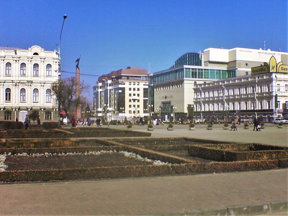
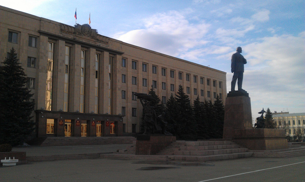
The villages of the Stavropol region are large and populous and are located in river valleys. The greatest concentration of cities is in the region of the Caucasian mineral waters, including (1987 populations) Piatigorsk (121,000), Kislovodsk (110,00), Essentuky (84,000), Mineralnye Vody (75,000), and Georgievsk (62,000). Other, more dispersed, cities include Stavropol (306,000), Nevinnomyssk (116,000), and Budënnovsk (formerly Prikumsk, 54,000).
The current ethnic composition of the Stavropol region cannot be determined with certainty. Post–Second World War Soviet censuses claim that the Ukrainians have virtually disappeared. Statistics were manipulated to convey the impression that the contiguous Ukrainian ethnic territory did not extend beyond the borders of the Ukrainian Soviet Socialist Republic. According to the 1989 census, of the 69,200 Ukrainians in Stavropol krai, 33,400 (48.3 percent) reported Ukrainian as their mother tongue, 9,500 (13.7 percent) indicated their ability to speak it, and the remaining 26,200 (37.9 percent) did not know it.
Economy. Until the 1930s Stavropol was an agrarian region notable particularly for wheat and wool; now it has a mixed agricultural-industrial profile. Since 1914, industrial output has increased twentyfold; from 1940 to 1974 it increased twelvefold.
In the early 1950s about one-half of the land was cultivated, but during that decade more virgin steppe was broken. By 1974 plowland accounted for 63 percent of the total land area. Other land uses included pastures (22 percent), hayfields (3 percent), forests and scrublands (2 percent), orchards and vineyards (2 percent), and nonagricultural uses (10 percent). In most areas plowland accounted for 60–80 percent of total land uses. The mean annual harvest of all grains during the 1970–4 five-year period was 4.3 million t, of which 3 million t was wheat. Sunflower, occupying 70 percent of the sown area of all industrial crops, averaged an annual harvest of 206,000 t in the 1970–4 period. Orchards occupied 61,400 ha, mainly in the region's western and southwestern part; vineyards covered 17,500 ha, mostly in the Kuma valley.
The livestock sector provided 58 percent of agricultural production in 1974. The animals (in Stavropol krai outside the Karachai-Cherkess Autonomous oblast) included 1.1 million cattle (40 percent of all standard animal units), 5.8 million sheep and goats (48 percent), 0.9 million pigs (6 percent), and nearly 10 million fowl (6 percent). Sheep raising was very important; it accounted for 11 percent of all the fine-fleeced merinos in the Union of Soviet Socialist Republics.
Irrigation has gained great importance in Stavropol agriculture. The area irrigated increased from 44,000 ha in 1950 to 65,000 ha in 1960, 167,000 ha in 1970, and 234,000 ha in 1975. There were 1.5 million ha of water-supplied pastures.
Of the industries, food processing is the most important branch (contributing 29.3 percent of the industrial output in 1974); it is followed by light industry (21.8 percent). Since the 1950s the development of machine building and metalworking (17 percent) and the chemical branch (13.4 percent) as well as the fuel- and power-generating industries (about 3 percent in 1974) has diversified the industrial profile. In 1974 Stavropol krai produced 9,385 million kwh of electricity (compared to 58 million kwh in 1940), mostly at thermoelectric power stations at Nevinnomyssk and Stavropol as well as small hydroelectric power stations elsewhere.
Gas and oil extracting began in the region during the 1950s. By 1974 gas production had reached 13 billion cu m, or 5 percent of the USSR output (mostly in the northern part of Stavropol krai), and crude oil production had attained 7 million t, or 1.5 percent of the Union of Soviet Socialist Republics output (in the east, along the Kuma river). At first the Stavropol gas was piped through Rostov-na-Donu to Ukraine, Moscow, and even Leningrad. Now, with its declining reserves, it has been overshadowed by gas from Orenburg and Western Siberia. Crude oil is transported by pipe from Zaterechnyi to refineries at Groznyi.
The food-processing industry is spread throughout the region, with major branches consisting of meat processing (Stavropol, Piatigorsk, Kislovodsk, and other cities), milling (Stavropol, Nevinnomyssk, Georgievsk, and elsewhere), canning (Georgievsk, Essentuky, Izobilnyi), oils (Nevinnomyssk and Georgievsk), and wine making.
Light industry is represented by the textile factory in Nevinnomyssk and garment making in Stavropol, Kislovodsk, Piatigorsk, and Essentuky. Reinforced-concrete products are made in Stavropol, Piatigorsk, and Mineralnye Vody, and wall construction materials and soundproofing in Stavropol. Woodworking and furniture making are of small, local significance. Resorts based on the Caucasian mineral waters at Kislovodsk, Piatigorsk, Essentuky, Zheleznovodsk, and Mineralnye Vody had USSR-wide significance.
The Stavropol region is not generously supplied with railway lines (846 km, just short of 1 km/100 sq km). A major electrified trunk line from Rostov-na-Donu traverses the southwestern part of the region toward Baku. It links the Stavropol region with the Kuban and Ukraine to the west and northwest.
BIBLIOGRAPHY
Fadeev, A. Ocherki ekonomicheskogo razvitiia stepnogo Peredkavkaz’ia v doreformennyi period (Moscow 1957)
Stavropolskii krai: Spravochnik (Stavropol 1961)
Gnilovskii, V.; Babenysheva, G. Geografiia Stavropolskogo kraia (Stavropol 1972)
Don i stepnoe Predkavkaz’e: XVIII–pervaia polovina XIX v., 2 vols (Rostov-na-Donu 1977)
Volodymyr Kubijovyč, Ihor Stebelsky
[This article originally appeared in the Encyclopedia of Ukraine, vol. 5 (1993).]


