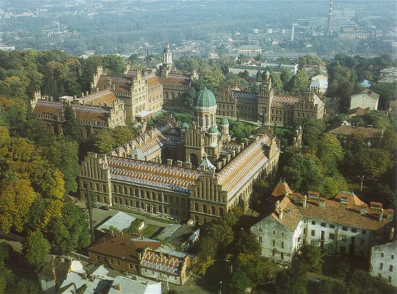
Chernivtsi oblast
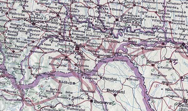
Chernivtsi oblast [Чернівецька область; Černivec'ka oblast']. Chernivtsi oblast lies in southwestern Ukraine, bordering on Romania and Moldova. It was formed on 7 August 1940 out of the northern parts of Bukovyna and Bessarabia. Its area is 8,100 sq km, and its population is 906,700 (2018), of which 43 percent is urban. The oblast has 11 raions, 11 cities, 8 towns (smt), and 398 villages. Its capital is Chernivtsi.
The oblast can be divided into the following regions according to economic and geographic conditions: the plateau region between the Prut River and the Dnister River, with its intensive agriculture and concentration of food-processing and building-materials plants; the city of Chernivtsi and the surrounding region, with well-developed machine-building, light, and chemical industries; the foothill regions (on the right bank of the Prut) with light industry and an agriculture based on grain, potatoes, flax, and cattle raising; and the mountain region, where lumber and woodworking industries and sheep raising are concentrated.
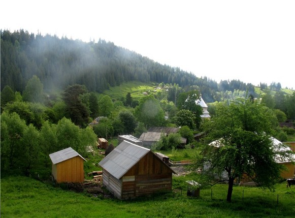
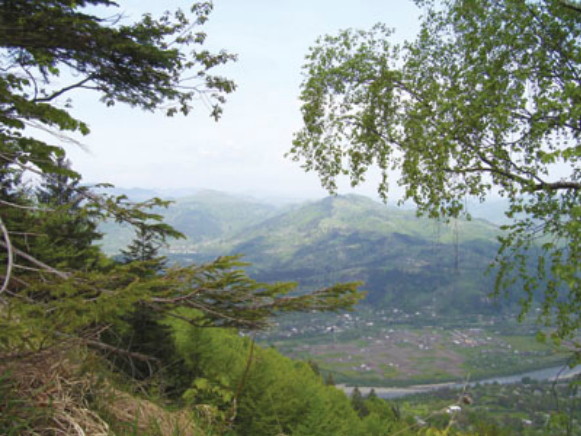
Physical geography. Chernivtsi oblast lies within three geographical regions: the southwestern, mountainous part is in the Carpathian Mountains (more precisely, the Maramureş-Bukovynian Upland and the Hutsul Beskyd, with a maximum elevation of 1,565 m); the middle part, consisting of the foothills, is in Subcarpathia (maximum elevation 537 m); and the northern part, an undulating plateau, is in the Pokutian-Bessarabian Upland (reaching an elevation of 515 m). The climate is moderate continental except in the Carpathians, where it is of the mountain type. The July temperature is 10–18°C in the mountains, 17–19°C in the foothills, and 19–20°C on the plateau. The January temperatures are –6° to –10°, –5° to –6°, and –4° to –5°C respectively. The annual precipitation is 800–1,200 mm in the mountains, 650–800 mm in the foothills, and 500–650 mm on the plateau. In the mountains the growing season is 136–162 days; in the other parts it is 205–215 days. The main waterways in the oblast are the Dnister River, Prut River, and Seret River. The soils in the foothills are mostly peat-podzolized soils, and in the mountains they are brown forest soils and peat-brown soils. The mountains and foothills support forests (beech is dominant on the lower slopes, fir on the higher); the plateau corresponds with the forest-steppe belt. Forests cover 31.8 percent of the oblast's area (2013 figures).
History. Until the 13th century the present Chernivtsi oblast formed part of Kyivan Rus’. Then it belonged to the Principality of Galicia-Volhynia, and from the second half of the 14th century to Moldavia. In 1774 the western (Bukovyna) part of the territory was incorporated into Austria. The northeastern part belonged to Russia after 1812 and was called Bessarabia oblast (later gubernia). From 1919 the whole territory was controlled by Romania. From August 1940 it belonged to the Ukrainian Soviet Socialist Republic and after 1991, to Ukraine.
Population. The average population density of the oblast is 112 people per sq km (2018). The density is highest (140–160) in the northwestern part, which is one of the most densely populated regions of Ukraine. Lowest densities occur in the Carpathian Mountains. The percentage of urban population increased from 19.5 percent in 1940 to 27.3 percent in 1960, 34.6 percent in 1970, and then 42 percent in 1989. In 2001 it dropped slightly to 40 percent, rising again to 43 percent in 2018. The population grew steadily after the Second World War losses until 1993: it was 820,000 in 1940, partly recovered by 1960 to 782,000, grew to 845,000 in 1970, 896,500 in 1979, 938,000 in 1989 and was 922,800 in 2001. The population reached 946,300 in 1993, dipped to 904,000 in 2009 and then recovered to 906,700 in 2018. The birthrate was quite high (14.7 per thousand inhabitants in 1991) declining to 12.4 per thousand in 1995, when death rates (12.7 per thousand inhabitants) surpassed it, resulting in a natural decrease of population. Out-migration, exceeding in-migration, contributed to the population decline beginning in 1993. A reversal in the net out-migration in 2006 slowed down and temporarily reversed the population decline.
Because the Ukrainian-Romanian border does not coincide exactly with the ethnic boundary, a considerable proportion of the oblast’s inhabitants are ethnic Romanians. The ethnic composition of Chernivtsi oblast in 2001 (1959 figures in parentheses) was Ukrainians, 75.0 (66.9) percent; Romanians (including Moldovians), 19.8 (19.6) percent; Russians, 4.1 (6.6) percent; Poles, 0.4 (0.8) percent; and Jews 0.2 (5.4) percent.
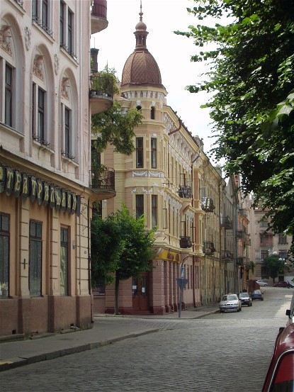
The oblast has only one large city, Chernivtsi (pop 265,700 in 2018). The other cities, such as Khotyn and Storozhynets, have fewer than 15,000 inhabitants. In 2017 the oblast had 13 professional-technical schools with 8,100 students and 3 postsecondary institutions with 21,800 students, including Chernivtsi National University.
Economy. Chernivtsi oblast is an industrial-agrarian region. Industry developed mainly after the Second World War, when existing enterprises were reconstructed and new industries were established; these included machine building, metalworking, and equipment making. The main branches of agriculture are grain growing, industrial crops, and cattle feeding. After 1991, as the market economy developed and state enterprises were restructured, private firms and services gained importance and agriculture regained its prominence. By 2017, agriculture contributed to the gross regional product of the oblast 25 percent, industry 12 percent, trade 11 percent, financial services 11 percent, transport and communications 5 percent.
Industry. Industries of the oblast usually process imported metals and local agricultural products. Energy for industry comes mostly from outside the oblast. Petroleum is brought in from Lviv oblast and Ivano-Frankivsk oblast, coal from the Donbas and the Lviv-Volhynia Coal Basin, and natural gas is piped in from Kosiv. Electricity originates from both the Burshtyn regional power station in Ivano-Frankivsk oblast and its own hydroelectric station at Novodnistrovsk. The industrial profile of the oblast has shifted over the years. In 1970 the food industry accounted for 41 percent of industrial production. Light industry came second (28.5 percent), followed by machine building and metalworking (11.7 percent), and lumber and woodworking (9 percent). By 1990 both the food industry (26.8 percent) and light industry (24.4 percent) lost ground to machine building and metal-working (28.6 percent). Food industry regained its primacy thereafter, accounting for about 32 percent of industrial output by value in 2017, while machine building and metal-working reverted to 11 percent. The main branches of the food industry are sugar refining (concentrated in Chernivtsi, Kostryzhivka, Nelypivtsi, and Zarozhany), meat packing and dairy processing (Chernivtsi and Novosilka), oil and fat production (in Chernivtsi), distilling, and fruit processing. The largest enterprises in light industry are a textile plant and a hose, knitwear, and clothes factory in Chernivtsi. Others include fur and leather goods, kilim-making and embroidery. The oldest branch of industry is the lumber, woodworking, furniture, and veneer industry, with plants in Chernivtsi, Vyzhnytsia, Berehomet, Storozhynets, Khotyn, and Putyliv. Bukovynian furniture made in Chernivtsi is renowned beyond Ukraine. The main enterprises of the machine-building and metalworking industries are located in Chernivtsi: a machine-building plant for the petroleum industry, chemical industry, electric industry, and light industry; and a factory producing farm implements. A chemical plant produces material for rubber footwear made in Chernivtsi. Building materials such as brick, tiles, ceramic products, reinforced concrete, and wall materials are produced by plants in Chernivtsi, Kostryzhivka, Kelmentsi, Storozhynets, and Sokyriany. The Hutsul region is famous for its handicraft industries: wood carving, kilim weaving, and embroidery.
Agriculture. In Chernivtsi oblast the main branches of agriculture are grain and sugar-beet growing, dairying, and meat livestock-raising. Since 1991, collective farms and state farms were replaced by commercial family farms, various forms of farming associations and corporate farms. Thus, while in 1984 in Chernivtsi oblast there were 148 collective farms (208 in 1970 and 151 in 1976) and 34 state farms (2 in 1970 and 33 in 1976), by 2009 there were 780 commercial family farms, 118 farm corporations, 89 farm enterprises, 21 farm co-operatives, 6 state farms, and 22 other farming enterprises. Farmland declined slightly from 474,400 ha or 58.6 percent of the oblast’s total area in 1976, to 470.6 ha (58.1 percent of the area) by 2013, while the built-up area increased to 4.9 percent and land under water to 2.3 percent. In 1976, 72.8 percent of this land was cultivated, 6 percent in perennial plantings, 7.3 percent was in hayfields and 13.9 percent was pasture. By 2013, the share of cultivated land declined to 70.8 percent, perennial plantings remained at 6 percent, hayfields increased to 8.7 percent and pastures to 14.5 percent. The crop mix also had some adjustments. Of the 351,400 ha sown in 1976, 147,300 ha (41.9 percent) were devoted to grains, 40,800 ha (11.6 percent) to industrial crops, 32,000 ha (9.1 percent) to potatoes and vegetables, and 126,300 ha (35.9 percent) to fodder. By 2007, total sown area declined to 259,900 ha, of which 118,100 ha (45.4 percent) were in grains, 29,600 ha (11.4 percent) in industrial crops, 42,900 ha (16.5 percent) in potatoes and vegetables, and 69,200 (26.6 percent) in fodder. Among the grains, corn (47,700 ha in 1976, 54,200 ha in 2018) and winter wheat (45,800 ha in 1976, 41,700 ha in 2018) are predominant. Soybean gained importance (60,000 ha in 2017). The main industrial crops were sugar beet (declining from 35,800 ha in 1976 to 2,800 ha in 2014) and flax (particularly in the foothills), while sunflower (from 4,300 ha in 1995 to 17,200 ha in 2017) and rape (12,400 ha in 2018) became lucrative. Fruit orchards in the Khotyn and Sokyriany regions produce apples, plums, pears, and cherries. The area devoted to fruits, berries, and grapes declined from 33,100 ha in 1976 to 28,200 ha in 2013. Crop yields fluctuated with weather from year to year, but their average yields have not improved significantly in three decades. Only after 2005 a rising trend was observed. Thus in 1970–5 the average grain yield was 28.3 centners per ha, in 2003–7, 31.5, and in 2011–15, 46.8; the sugar-beet yields, respectively, 333.8 (the highest in Ukraine), 253.0 and 353.4; the potato yields, 136.8, 136.1, and 179.2. The leading branch of animal husbandry, which accounts for half of the agricultural income, is beef and dairy cattle raising. Hog farming and sheep farming (particularly in the mountain regions) were expanding until the mid-1980s. Poultry farming and apiculture are of less importance. In 1990 there were 448,400 head of cattle (of which 145,700 were cows), 346,600 hogs, 148,800 sheep and goats, and 4.16 million poultry. By 2017 their numbers declined to 89,100 head of cattle (of which 56,200 were cows), 147,200 hogs, 44,200 sheep and goats and 2.98 million poultry. The decline of domestic animals numbers was even greater in other oblasts, so the relative standing of Chernivtsi oblast slightly increased.
Transportation. The oblast has 413 km (2009 figures) of railway track, down from 461 km in 1990. The following railway lines run through Chernivtsi: the Chernivtsi–Zhmerynka–Kyiv line, the Chernivtsi–Kishinev–Odesa line, and the Lviv–Chernivtsi–Bucharest line. Chernivtsi is the main railway junction. There are 2,800 km (2009) of hard surface road in the oblast, down from 3,000 in 1990. The Chernivtsi–Lviv, Chernivtsi–Kyiv (through Ternopil), and Chernivtsi–Kishinev–Odesa highways run through the oblast. Air routes connect Chernivtsi with Kyiv and the oblast capitals of Ukraine. A pipeline carries natural gas from Lviv oblast to Chernivtsi.
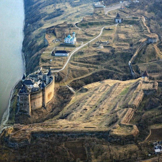
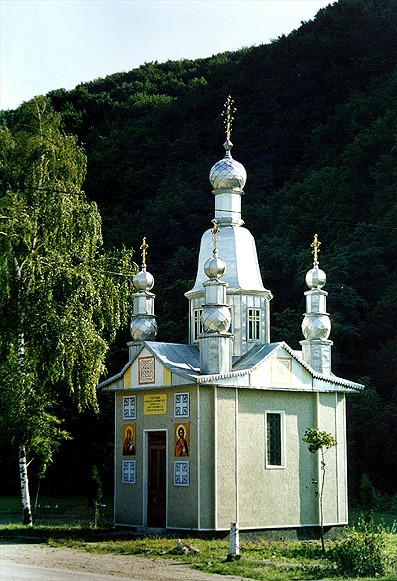
Tourism. Tourism is an important industry in the Carpathian Mountains, along the Cheremosh River, and in Chernivtsi. The oblast has both natural and cultural resources for tourism. Among its natural attractions are the Vyzhnytsia National Nature Park (est. 1995, 7,900 ha), the Cheremosh National Nature Park (est. 2009, 7,100 ha), the Khotyn National Nature Park (est. 2010, 9,400 ha), the Chernivtsi Regional Landscape Park (est. 1996, 21,500 ha), the botanical garden and dendrological park of Chernivtsi National University (1876), the Storozynets Dendrological Park (1912), 12 natural preserves, and 8 natural monuments. Cultural attractions include in Chernivtsi a symphony orchestra, some museums and theaters. Historic monuments are more widespread, including the Turkish fortress at Khotyn. Resorts feature Hutsul folk culture in its mountain environment or mineral waters and mud baths. In 2008 Chernivtsi oblast accommodated 81,000 tourists (of whom 6,700 were foreign guests) registered in 27 hotels and resorts.
(See also Bessarabia and Bukovyna.)
BIBLIOGRAPHY
Vashchenko, A. Pryrodni resursy zakhidnykh raioniv URSR. Ekonomichno-heohrafichnyi narys (Lviv 1959)
Komarnyts'kyi, A. Bukovyna (Uzhhorod 1966)
Istoriia mist i sil Ukraïns'koï RSR. Chernivets'ka oblast' (Kyiv 1969)
Rozkvit ekonomiky i kul'tury Radians'koï Ukraïny (Lviv 1969)
Ukraina. Raiony (Moscow 1969)
“Chernivets'ka oblast',” Heohrafichna entsyklopediia Ukrainy, vol 3 (Kyiv 1993)
Bukovyna: istorychnyi narys (Chernivtsi 1998)
Chernivets'ka oblast': Heohrafichnyi atlas (Kyiv 2007)
Bezpal'ko, R., Khryshchuk, S. “Suchasnyi stan vykorystannia zemel' sil's'kohospodars'koho pryznachennia Chernivets'koi oblasti,” Heodeziia, kartohrafiia i aerofotoznimannia, vyp. 77 (Kyiv 2013)
“Chernivets'ka oblast',” Statystychnyi atlas Ukrainy (Kyiv 2017) http://www.ukrstat.gov.ua/
Arkadii Zhukovsky, Ihor Stebelsky
[This article was updated in 2019.]

.jpg)
.jpg)
.jpg)
