Sevastopol
Sevastopol or Sevastopil [Севастополь or Севастопіль; Sevastopol' or Sevastopil'], in English, commonly called Sebastopol. See Google Map, see EU map: IX-14. The largest city in the Crimea (2021 pop 429,922) and a deep water port on the Black Sea. The land area of the Sevastopol district (864 sq km) includes the city of Sevastopol, the former cities (until their incorporation since 1957) of Inkerman and Balaklava, and other villages to the north and southeast (2021 urban pop 479,394, total pop 509,992). Containing military bases, it had a special status in the Russian Empire, the Union of Soviet Socialist Republics, and in post-Soviet Ukraine. After Russian annexation in 2014, it was designated the Federal District of Sevastopol on par with the Autonomous Republic of Crimea. The city and its district is the terminus of a railway (single-track, electrified) connecting it to Simferopol and beyond. Highways connect it NE to Simferopol (H06) and ESE to Yalta (H19).
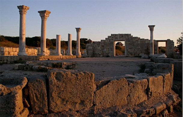
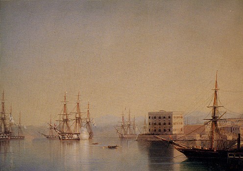
History. The region was inhabited by the Taurians from the beginning of the 1st millennium BC. In 422–21 BC the ancient Greek colony of Chersonese Taurica (in Greek, ‘Peninsula of Taurica’) was established by settlers from Heraclea Pontica on the west side of the present-day city (see Ancient states on the northern Black Sea coast). This Hellenic-Roman-Byzantine fortified city was destroyed (1399) by the Golden Horde. In 14th –15th centuries, this area became part of the Kingdom of Theodoro with its port at Kalamita (at the eastern end of Sevastopol Bay). In 1475–1781 it was part of the Ottoman Empire, when Kalamita was re-named Inkerman and at the present site of Sevastopol city center a Tatar village called Ak-Yar (‘White Cliff’) came into existence. Upon Russia’s annexation of the Crimea in 1783, that site was selected for a fort and naval base (its establishment credited to Rear Admiral Thomas Mackenzie) and named in Russian after the Tatar village, Akhtiar. Catherine II, however, preferred a classical Greek name, but since Kherson was already taken for the city on the Dnipro River, she ordered (in 1784) the fortress be enlarged and re-named Sevastopol—the ‘City of Glory’ from the Greek sebastos ‘noble’ and polis ‘city’. Although in 1797 Paul I ordered the city’s name revert to Akhtiar, this order was rescinded in 1826 by Nicholas I. In 1804 it became the home of the Russian Black Sea Fleet. Most of its sailors (about 70 percent) and many officers (about 35 percent) came from Ukrainian families and spoke Ukrainian. The city acquired the Admiralty ship repair and building complex, was fortified, and grew from 30,000 inhabitants at the beginning of the 19th century to 47,400 in 1853. During the Crimean War (1853–6, for which 10 regiments were drawn from the Ukrainian gubernias and 2 battalions of scouts from the Kuban Cossack Host) the city, suffering an 11-month siege, was almost completely destroyed. After the war it was demilitarized. In the 1870s its naval facilities were rebuilt and expanded. A railway connecting it with the grain-growing interior was completed (1875), thus adding a commercial component to the port, which functioned until 1894, when it was transferred to Teodosiia. The population of the city recovered and grew rapidly, from 11,000 in 1875 to 53,600 in 1897 (in the Sevastopol district, 57,500), becoming the largest city in Crimea. Many of the residents were naval personnel, the males outnumbering females 8:1. According to the 1897 census, only 27 percent of the population was born here; 15 percent were born in other parts of Tavriia gubernia, 54.4 percent were born in other parts of the Russian Empire and 3.3 percent were born abroad. The two largest contingents of immigrants from other parts of the empire came from southern Ukraine: Katerynoslav gubernia 5,306 (18.2 percent) and Kherson gubernia 4,211 (14.4 percent); another 3,973 (13.5 percent) came from the other 7 gubernias of Ukraine. Of the residents of Sevastopol, the census-takers identified only 7,322 (13.7 percent) Ukrainian speakers. Aside from the dominant Russian speakers (63.5 percent), the third largest group was Jewish (6.9 percent), then Polish (5.1 percent), Tatar (3.4 percent) and Greek (2.9 percent).
From the 1840s, the Kobzar organization spearheaded Ukrainian national enlightenment in the city; after 1905, it gained legal status. It was led by Viacheslav Lyshchenko, director of the State Girls’ Gymnasium, and its main work was performed by Ukrainian officers of the Black Sea Fleet, including the legendary captain Lev Matsiievych (one of the earliest aviators in the Russian Empire). In March 1917 Kobzar held a meeting of Ukrainian sailors, which began a movement for the Ukrainization of the Black Sea Fleet. In April 1917 the Ukrainian Black Sea Society was established, its executive housed in the Union Bank on the main street of the city. Its sections of activity were: military, educational, propagandistic, and economic. Until November 1917, it hosted Ukrainian choirs, drama groups, the Ukrainian publisher Atos, and coordinated the raising of Ukrainian flags on ships.
During the First World War and Ukraine’s struggle for independence (1917–20), the Third All-Ukrainian Military Congress in Kyiv (20 October 1917), decided to Ukrainianize the Black Sea Fleet where, its delegates claimed, 70 to 80 percent of the sailors were ethnic Ukrainians. Indeed, the day before the Central Rada in Kyiv proclaimed the Third Universal of the Central Rada (19 November 1917), nearly one-half of the ships of the Black Sea Fleet raised the Ukrainian flag. By the beginning of 1918 the Ukrainians of Sevastopol established their first self-funded 6-grade Ukrainian elementary school. The other contenders for control of Sevastopol were the Mensheviks—Social-Revolutionary Council of Deputies of Army, Fleet and Workers—and the Bolshevik Military-Revolutionary Committee. The Crimean Tatar movement was centered outside Sevastopol, in Bakhchysarai. The Bolsheviks seized control of Sevastopol (14 January 1918), slaughtered some 250 Black Sea Fleet officers (22–23 February 1918), and proceeded to conquer the rest of the Crimea. Thus threatened, the Crimean Tatar Republic’s National Directorate, based in Simferopol, reached an accord with the Ukrainian National Republic to become part of Ukraine. As the UNR Army forces commanded by Col Petro Bolbochan responded from mainland Ukraine by taking Simferopol and Bakhchysarai from the Bolsheviks, the Bolshevik controlled ships, having had bombarded and captured Yalta and Teodosia, retreated to Novorossiisk, while the Ukrainian sailors, with the expectation of victory, again raised the Ukrainian flag (29 April 1918) on the remaining ships of the Black Sea Fleet. However, they had to yield to the Germans, who occupied the city (May–November 1918). Then Sevastopol was occupied by the Anglo-French Allied Powers who pillaged the fleet (November 1918 to April 1919), the Bolsheviks (May 1919), and Anton Denikin’s forces (June 1919), when it served as headquarters of Petr Wrangel and his South Russia government (April to November 1920) before it was taken, finally, by the Red Army. Then Sevastopol, along with the rest of the Crimea (the Crimean Autonomous Soviet Socialist Republic), became part of the Russian Soviet Federated Socialist Republic.
After the war the city’s port and industries were rebuilt by 1928. Its population grew from 74,070 in 1921 to 74,703 in 1926 (the Sevastopol district had 96,700 residents in 1926) and to 112,000 in 1941. According to the 1926 census, the number of Ukrainians and their share in the city’s population had declined to 8,596 (11.5 percent). The city’s remaining five largest ethnic groups were as follows: Russians (68.9 percent), Jews (9.1 percent), Tatars (1.6 percent), Greeks (1.6 percent), and Poles (1.5 percent).
During the Second World War Sevastopol resisted the Germans for eight months before surrendering in July 1942. The Germans who occupied the city (1942–44) called it Theodorichafen (named after the medieval ‘Gothic’ kingdom, Theodoro). After its recapture in May 1944 the city was in ruins.
In 1945–55 Sevastopol was rebuilt and expanded. Many Ukrainians joined the effort, especially after it became part of the Ukrainian SSR in 1954. By 1959 the city’s population had reached 142,000 (the Sevastopol district’s, 148,000, of which 19 percent were Ukrainian and 76 percent Russian), and then continued to grow to 228,900 (1970), 301,000 (1979), 356,000 (1989, when 20.7 percent were Ukrainian and 74.4 percent Russian), reaching 366,000 (1991).
The Ukrainian movement revived in Sevastopol in 1989 with the activity of the Prosvita society and the establishment of the Sevastopol Society of the Ukrainian Language (22 May 1989). The latter re-started Ukrainian cultural activity: a Ukrainian folk choir (Victor Kovalchuk, conductor) and a drama actors group (led by Oleksandr Hulaiev, Borys Mazur, and Liubov Hulaiev). Two Prosvita members, the medical doctor Leonid Amelkovych and the Black Sea Fleet signals captain Ihor Teniukh, were elected (1990) deputies to the Sevastopol city council, where the latter spoke in Ukrainian. Prosvita also published its first (and last) issue of the Ukrainian-language newspaper Promin’. It also campaigned to vote for Ukraine’s independence in the December 1991 referendum (supported by 57 percent of the voters). Members who were officers in the Black Sea Fleet established the Sevastopol branch of the Association of Officers of Ukraine and began to campaign for the establishment of the Ukrainian Navy.
Following the 1991 Ukraine’s Declaration of Independence, Sevastopol was declared the principal base of the Ukrainian Navy. As the key naval base of the former Soviet Black Sea Fleet, it became a locus of tension in Russia–Ukraine relations until the Black Sea Fleet was divided between the Russian Federation and Ukraine and a set-term lease agreement signed in 1997. Sevastopol remained the headquarters for both the Russian Black Sea Fleet and the Ukrainian Navy. Both navies co-used the city’s harbors and piers. Tension increased again in 2008, when the Russian Federation used its Black Sea Fleet against Georgia and took control over light houses in the Crimea. President Viktor Yushchenko in his re-election campaign (23 November 2009) vowed to have the Russian Black Sea Fleet leave Ukraine’s Crimea by 2017, as agreed in 1997. Yushchenko lost the election to Viktor Yanukovych, who renewed the lease in 2010 until 2042.
Meanwhile, the population of Sevastopol grew until it reached 375,000 in 1993 and then began to decline, due to declining economy and aging population, to 365,000 (1996), 343,000 (2001), and 340,000 (2006). It resumed growth in 2012 at 341,000 to reach 344 853 by the beginning of 2014. The 2001 population census recorded an increase in the share of Ukrainians to 22.4 percent of the Sevastopol district’s population; the other main ethnic groups were (in percent): Russians (71.6), Belarusians (1.6), Tatars (0.7), Crimean Tatars (0.5), Armenians (0.3), Jews (0.3), Moldavians (0.2), and Azeris (0.2). Of the self-declared ethnic Ukrainians, 29.6 percent considered Ukrainian as their mother tongue but 70.1 chose Russian. Media and schooling was conducted in Russian, which promoted linguistic Russification.
Prosvita resumed its self-funded and patriotic donor-supported publication activity in March 1995 with the newspaper Dzvin Sevastopolia (monthly; ed. Mykola Huk, 1995–9; Valko Kravchenko, 2000–1; Mykola Huk, 2002–3; Volodymyr Protsenko, after 2003). There it supported local writers by publishing their works, including the book by Valko Kravchenko: Ukrains'kyi Sevastopol' (Ukrainian Sevastopol). It also promoted the establishment of libraries with Ukrainian books (at Prosvita, the Ukrainian cultural-informational center, the Ukrainian-Canadian library at the center for raising qualifications of civil servants), the establishment of a portal Ukrains'ke zhyttia v Sevastopoli (Ukrainian life in Sevastopol: http://ukrlife.org/) by Mykola Vladzimirsky in 2000 and the introduction of Ukrainian language program Prolisok on a Sevastopol radio station.
Education in Ukrainian was vehemently resisted by the Sevastopol elite. When the Prosvita society established its Ukrainian Sunday school in 1990, funded by its own members, it was trashed the day after it opened and its locks were changed. Parents resorted to home teaching while demanding instruction in Ukrainian at government schools. Their demands were hardly met in 1992 when Ukrainian was offered as an optional course. In 1996 the Prosvita members campaigned for Ukrainian schools, compelling the administration to promise three Ukrainian schools (the Ukrainian Lyceum No. 8, the Ukrainian Gymnasium No. 53 [its cornerstone was laid with pomp by President Leonid Kuchma in 1998], and the Ukrainian Boarding School No. 70). Only the Ukrainian Boarding School, using an old building, was opened. Ukrainian language was introduced as a separate subject in some Russian language schools. Thus by 2003 there were 7 schools in which 39 classes with more than 600 pupils took courses in Ukrainian language. Even so, this amounted only to 2 percent of all students in Sevastopol, where ethnic Ukrainians made up 22.4 percent. Beginning in 2010, under President Viktor Yanukovych and education minister Dmytro Tabachnyk, classes in the only Ukrainian school were being closed, beginning with grade 1.
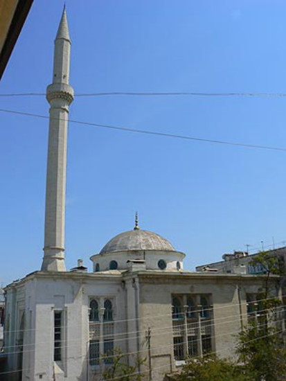
Meanwhile, with the demise of Communism, religious practices revived; churches were reopened or restored and new ones built. By 2007 there were 97 religious parishes or organizations in Sevastopol, of which 43 were of the Ukrainian Orthodox Church-Moscow Patriarchate (formerly the Russian Orthodox church), 10 Baptist, 7 Muslim, 8 Jehovah’s Witnesses, 4 Fifth-Day Adventist, 3 Seventh Day Adventist, 3 Ukrainian Greek Catholic, 2 Evangelic Christian, 2 Evangelist, 2 Jewish, 1 Ukrainian Orthodox Church-Kyiv Patriarchate, 1 Ukrainian Autocephalous Orthodox church, and 1 Roman Catholic church.
In post-Soviet independent Ukraine, state enterprises had to adapt to market-based economy. Services and then industries were privatized. Demilitarization of the city included 1) de-commissioning of an underground submarine base at Balaklava (built in 1961, used by the Russian Black Sea Fleet until 1993, handed over to the Armed Forces of Ukraine in 2000, made into a museum in 2003), 2) the Soviet early warning radar at Cape Khersones (operational since 1975, staffed by Ukrainians but rented to the Russian Federation from 1992, transferred to civil Ukrainian Space Agency in 2005), and 3) the Belbek Air Force Base (since 1941, opened to domestic and international carriers in 2002–7, renewed in 2010). Since Sevastopol was no longer a closed city to foreigners, tourist services and recreational attractions expanded.
Following Russia’s annexation and re-militarization of the Crimea, according to the census of October 2014, the population of Sevastopol grew to 393,300; the share of self-declared ethnic Ukrainians (52,900) dropped to 14.2 percent while that of Russians (303.100) grew to 81.0 percent. Subsequently, the population of the Sevastopol district continued to grow rapidly: 399,000 (January 2015), 428,753 (2017) 443,000 (2019), and 510,000 (2021). Religious institutions were also affected, in that pro-Ukrainian institutions were harassed and all Ukrainian Orthodox churches were absorbed into the Russian Orthodox church, whose number of organizations had increased by 2020 to 69. The other groups included 3 Russian Old Believers, 6 Muslim, 5 Baptist, 6 Fifth-Day Adventists, 7 other Evangelists, 2 Jewish, 1 Roman Catholic, 1 Greek Catholic, 1 Lutheran, and one each of three other sects.
Economy. The basic functions of Sevastopol are a naval base and a commercial port with supporting commercial, manufacturing, government, educational and scientific services. The Sevastopol district provides the city with essential water and some food resources. In 2008, under independent Ukraine, the gross regional product of the Sevastopol district was distributed among sectors as follows: trade and repair activities (19.7 percent), real estate and infrastructure services (12.4 percent), manufacturing (11.9 percent), transportation and communications (11.7 percent), finance (8.2 percent), education (6.8 percent), energy production and distribution (4.2 percent), health (3.3 percent), social services (2.5 percent), and mining (1.9 percent); agriculture, forestry and fisheries accounted for the remaining 0.1 percent. Trade (export and import, in million US dollars) dropped sharply after Russian annexation and Western imposition of sanctions: 2013 – 96.2, 106.9; 2014 – 59.3, 102.9; 2015 – 47.8, 37.7; 2016 – 6.0, 33.4; 2017 – 5.4, 14.9; 2018 – 4.6, 9.6; 2019 – 6.0, 6.2; 2020 – 4.8, 5.1.
Sevastopol has significant ship, machine building and instrument making industries, supported with the fabrication of metal (steel, aluminum) and plastic products. There are three ship repair yards: 1. the largest, Sevastopol Marine Plant (the original Admiralty dockyard at Korabelna bukhta [Ship Inlet] of 1783, separated from naval base in 1919, operated three dry docks [since 2004, two dry docks] and a slipway; over its 200 years of operation it built over 500 vessels and repaired over 5,000 vessels; it built the largest floating cranes in the USSR; in 1980s it employed 16,000 people; privatized in the 1990s as the Persei ship repair plant, employment diminished to 200, then went bankrupt; after Russian occupation, nationalized and revived); 2. the Sevastopol Ship Repair Yard of the Black Sea Fleet (est 1945 at the small Kilen Inlet, 1.5 km east of the first, re-named 13 zavod VMS SSSR [1954–97], then Sevastopolskii sudoremontnyi zavod ChF Rossii [1997–2003] and since 2003 FGUP “13 SRZChF” Minoborony Rossii); 3. the Marine Industrial Complex (est. in 2004 on the north shore, repair and re-fitting of ships, 1 dry dock), and 4. the Balaklava Bay Shipyard (for yachts). The Parus Sevastopol Instrument Plant (est. 1960) made guidance systems for nuclear submarines and missiles (demilitarized and declined after 1991); the Maiak plant produces electrical and lighting equipment for ships; helicopters are repaired at the Sevastopol Aircraft Plant (overhaul of Ka-28, Mi-8, Mi-14 and Mi-17 helicopters); elsewhere SAM and radar EW complexes are assembled, overhauled, and maintained. Sevastopol also houses the Chernomorets design bureau for military ships.
The food industry includes a fishing port (built at Komyshova Inlet in 1964) and large fish-processing and canning plants, a meat packing plant, 2 wineries, a dairy, the making of flour products and bakeries. The building-materials industry includes limestone quarrying, the production of lime, pre-fabricated concrete and fiberglass. Other industries include clothing, knitwear, wood-working, rope-making, paper-making, printing and publishing. Local power is supplied by two thermal-electric power plants and a small solar panel farm.
Services include trade, real estate, banking, transportation and communications (12 newspapers or tabloids, 2 radio and 3 television stations [all in Russian]), medical facilities, research and education.
Research and education in the city gained significance in the 20th century. The main research institutions focused on the sea: 1) the Institute of the Biology of Southern Seas of the National Academy of Sciences of Ukraine (est. 1963 on the basis of the Sevastopol Biological Station, est. in 1871 [first in the Russian Empire and one of the earliest in Europe]); 2) the Marine Hydrophysical Institute of the National Academy of Sciences of Ukraine, with its aquarium (est. 1929, part of the Academy of Sciences of the Ukrainian SSR in 1961, moved from Katsiveli (near Yalta) to Sevastopol in 1963, in 2000 combined with the first to become the inter-branch Oceanology Center of the National Academy of Sciences of Ukraine, and 3) a branch of the former Moscow-based Oceanography Institute (est. 1943). After Russian annexation in 2014, administration of the Oceanology Center of the National Academy of Sciences of Ukraine was transferred to its branch in Odesa; those remaining in Sevastopol became part of the Russian scientific community.
Postsecondary institutions were primarily technical with military application; they gained humanities, social sciences, and business components in the post-Soviet Ukraine period. The institutions include: 1) the Economics and Humanities Institute (est. 1995, as a branch of the Tavriia National University, which was re-named in 2014 the Crimean Federal University), 2) the Sevastopol National Technical University, now the Sevastopol State University (est. 1951 as the Sevastopol branch of the Mykolaiv Shipbuilding Institute, then in 1960, as the Sevastopol branch of Odesa Polytechnical Institute, in 1963 became the Sevastopol Instrument Engineering Institute [SIEI], and in 1994 SIEI received the highest IV level of accreditation and was reorganized into Sevastopol State Technical University, granted the national university status in 2001, since 2014 re-named the Sevastopol State University), 3) the Sevastopol National University of Nuclear Energy and Industry, est. 1915 as the Second Marine Military School for Imperial Russian Navy, then [1924–31] the Soviet Navy pilots college, in 1954 became the Third Navy Engineering College and in 1964 the Sevastopol Higher Navy Engineering College training specialists for nuclear submarines, after 2014 re-named the Sevastopol Institute of Nuclear Energy and Industry), 4) the Nakhimov Naval Academy (est. 1937 as the Sevastopol Naval Institute, re-named in 1992 to academy, after 2014 reverted to original name in 2014, while 50 faculty and 103 students moved to the Odesa Naval Academy), 5) the Sevastopol Branch of the Moscow State University (est 1999, upon the initiative of the mayor of Moscow [Yurii Luzhkov], and the rector of Moscow State University the Sevastopol Banking Institute (branch of the Ukrainian Academy of Banking of the National Bank of Ukraine, est. 2009, ceased operation in 2014, liquidated in 2015 and replaced by a branch of the Russian Economic University).
Sports facilities were well developed in the Soviet post-war period. They included 3 training gyms and 3 football stadiums as well as sports fields at schools. The Sevastopol Sports Complex (opened in 1985) is home of FC Sevastopol (which replaced FC Chaika Sevastopol in 2002, then joined the Ukrainian Premier League in 2007, and the Russian league in 2014). In the post-Soviet period tourism increased. Presently there are about 80 hotels, 4 sanatoria, 9 boarding houses, 4 automobile camping grounds, 10 yacht clubs and over 10 diving centers.
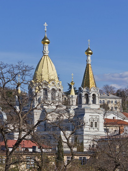
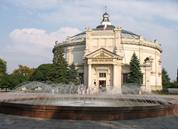
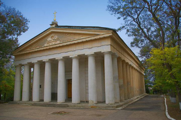
Culture. Despite Ukrainian contribution in the defense and development of Sevastopol, Russian culture prevails in the city. Institutions include the Leo Tolstoy Sevastopol Central Library, the M. Lazarev Marine Library, and other libraries, two drama theaters (the A. Lunacharsky Sevastopol Academic Russian Drama Theater, the B. Lavrentev Russian Drama Theater of the Black Sea Fleet), one dance theater and one childrens’ theater and four major museums: the Khersones Historical-Archeological Museum (est 1892, declared UNESCO world heritage site on 23 June 2013), the M. Kroshitsky Sevastopol Art Museum (est 1927), the Museum of the Black Sea Fleet (est 1869), and the Museum of the Defense of Sevastopol (est 1960, which includes the Panorama Museum ‘The Defense of Sevastopol, 1854–55,’ opened in 1905, re-built in 1945, and the Diorama Museum ‘Storming of Mount Sapun, 7 May 1944’, opened 1959). Other museums include the Sevastopol Dolphin Aquarium-museum of the Institute of the Biology of Southern Seas of the National Academy of Sciences of Ukraine, the Sevastopol Regional Studies Museum, and the Military Historical Museum of Fortifications, which comprises the 19th century St Michael’s battlement complex on the north shore and the Balaklava subterranean museum of de-commissioned docks for submarines. The main architectural monuments are the Doric Cathedral of Saints Peter and Paul (1843–8), the quay Grafska Prystan (1846), the Saint Nicholas’s Church (in the form of a pyramid, 1857), the Dormition Cathedral (designed by Valentyn Feldman, 1895–1905), the Saint Volodymyr Cathedral (presumably on the site where Volodymyr the Great was Christened in 988, designed by David Grimm in a neo-Byzantine style and built 1874–94 in the Khersones Tavriiskyi National Preserve, restored 1991–2004) and the Sevastopol Panorama (1905).
Most monuments in the city glorify imperial Russia/USSR and the Black Sea Fleet. Few imperial Russian monuments predate 1854: the ‘Catherine’s Mile’ (1786) and the Kazarovsky Monument (1839). Most pertain to the Crimean War: monuments to the English soldiers in the Inkerman Battle (1856, 2004), the Volhynian Infantry Regiment (1881), the Kyiv Hussar Regiment (1904), the Russian soldiers in the Inkerman Battle (1904, 2005), the Russian soldiers in the Balaklava Battle (1905, 2004), the Scuttled Ships (1905), the defenders of the Belkin Fortification (1905), the First Bastion (1905), the Fourth Bastion (1905, 1963), the British soldiers (at Derhachi, 2004), and the Malakhov Kurhan Memorial Complex (1905, 1950s). In the Soviet period the Second World War was memorialized with 15 monuments, including the gigantic ‘Soldier and Sailor’ (1972, 1981, 1988, 2008), and the tall (60 m high) ‘Bayonet and Sail’ (1977). Many military leaders or heroes were honored: Admiral V. Kornilov (erected in 1895), General E. Totleben (1909), Sevastopol-born Rear Admiral and Geographer I. Papanin (1954), Ukrainian sailor, Petro Kishka (soon after the Crimea became part of the Ukrainian SSR, in 1956), Admiral P. Nakhimov (1959, defender of Sevastopol, of Ukrainian Cossack descent, originally Nakhimovsky), Marshal V. Blukher (1973), General A. Suvorov (1983), Admiral F. Ushakov (1983) and, after the 1991 Ukraine’s Declaration of Independence, Admiral M. Kuznetsov (2000), and Admiral D. Seniavin (2014). The monument to Hetman Petro Konashevych-Sahaidachny (who destroyed Turkish fleet [at Trabzon,1614; Istanbul, 1615], captured Caffa [now Teodosia] and freed slaves [1622], erected in 2008), however, was removed in 2014 after the Russian Federation annexed the Crimea and donated to Kharkiv.
Of the three poets honored with monuments, the first was Aleksandr Pushkin (1983). Two monuments of Ukrainian poets were added: Taras Shevchenko (in Sevastopol, funded by Vasyl Sventytsky through the Ukrainian Canadian Foundation of Taras Shevchenko, 2003) and Lesia Ukrainka (in Balaklava, 2004); both still stand, although Russian activists tried to have the Shevchenko monument removed in 2016 but were successfully stopped by local Ukrainians with convincing counterarguments to the city administration.
Other monuments added during Ukraine’s independence were religious or political: a Memorial to Prince Volodymyr the Great (2001), three to Saint Andrew the Apostle (2003, 2005, 2013), to Saint George (2003), to Saint Cyril and Saint Methodius (2008), to Saint Nicholas (2010), to the Victims of Holocaust (2003), to the Deported Nations of Crimea (2008), and to the Liquidators of the Chornobyl nuclear disaster (2011), as well as to Empress Catherine II (2008, upon the 225th anniversary of the founding of the city).
Archeological sites include the Khersones Tavriiskyi National Preserve with its museum, its branches featuring the fortresses of Kalamita (at Inkerman) and Chembalo (on the east side of the entrance to Balaklava Inlet), and many archeological remains of various ages: the Mesolithic structure Murzak-Koba, the menhir (obelisk-shaped druid stone) at Rodnikovske, the Roman encampment near Balaklava and the (5th century) cave monasteries of the Zahaitan cliff.
Nature preserves in the district are: Cape Aiia (est. 1982, 1,340 ha, with relict plants and rare animals), ‘Baidar’ (est. 1990, 24,295 ha, with endangered plants), Cape Fiolent (est. 1996, 32 ha, with rare plants and animals), and Cossack Inlet (est. 1998, 23 ha, bird migration rest point, wintering place, with rare animals).
City plan. The Sevastopol district, which includes both the built-up area of Sevastopol around Sevastopol Bay and the outlying rural areas to the north and southeast, appears on a map like an irregular triangle in the southwestern corner of the Crimea. It is bound by the Black Sea in the west and southwest (from Cape Lukull in the north to Cape Khersones in the southwest, about 36 km, and then southeast to Cape Sarych, about 39 km); in the east it borders the Bakhchysarai raion (about 75 km) and in the southeast corner, the Yalta district (12 km). It occupies an area of 1,079 sq km, of which 864 sq km comprises land surface and the remaining 215 sq km the water surface of Sevastopol Bay and its inlets.
The Sevastopol district is divided into four administrative (city raion) sections. The smallest, Lenin raion (26 sq km, 114,862 urban pop in 2017), contains the western half of old Sevastopol. From the south shore of Sevastopol Bay and the west side of Pivdenna/Yuzhna bukhta (Southern Inlet), it extends (2.4 km) west to the next, Karantynna bukhta (Quarantine Inlet) and south of the bay (about 7 km) to Mykolaivka. The somewhat larger Gagarin raion (61.1 sq km, 149 726 urban pop) extends west of Lenin raion to Cape Khersones. East of Lenin raion is the large Nakhimov raion (267.74 sq km, 102,213 urban, 12,544 rural pop); it extends from the eastern half of old Sevastopol (3 km east and 4.5 km south), across Sevastopol Bay through the built-up north shore and up to 24 km north of the bay into rural areas (12 villages, rural pop 12,544) with vineyards and orchards in the lowlands of the Belbek River and Kacha River (where the Belbek Air Force Base, the town [SMT] Kacha [urban pop 4,996] and the Kacha Naval Air Base are located) and east to the wooded higher elevations of Mackenzie Mountains. The fourth and largest, Balaklava raion (530.44 sq km, 31,269 urban, 18,139 rural pop), extends from the city of Inkerman (urban pop 10,196) 25 km to Balaklava (urban pop 21,073) on the south shore of the Crimea, with cottage gardens, vineyards and orchards along the way, and then east (32 km) into the Chorna River basin with its 17 villages and the Chornorichenske water reservoir in the wooded elevations of the Crimean Mountains.
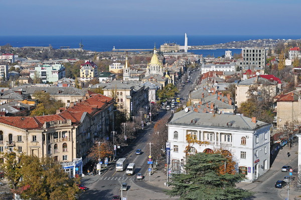
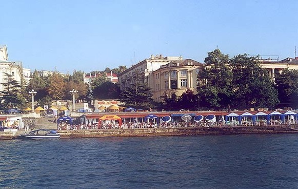
Sevastopol is a picturesque city stretched out along the northern and southern shores of Sevastopol Bay and the north coast of the Heracles Peninsula. The city’s current built-up area, with breaks for hills, ravines and water bodies, extends about 17 km from east to west, 10 km from north to south, and occupies about 103 sq km, of which 50 sq km is residential, 16 sq km commercial, 20 sq km industrial, and 17 sq km devoted to transportation and communication. Many of its buildings are finished in white limestone (quarried at Inkerman), and the broad avenues are lined with trees.
Sevastopol Bay (itself a Holocene submerged canyon or ria of the Chorna River) has one long deep inlet on the south side; the peninsula shoreline to the west has 7 more inlets. The inlets cutting into the shoreline and ravines restricted the layout of streets to gentler slopes and plateaux; as the city grew, its new street grids and built-up areas were connected by arterials and bypasses.
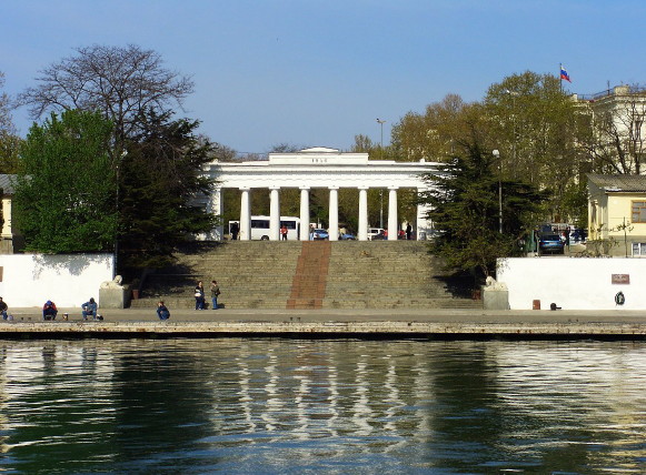
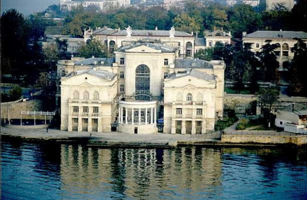
The bay’s long deep inlet, Pivdenna bukhta (Southern Inlet), was chosen (1783) as the site of Sevastopol and a harbor for the Black Sea Fleet. Its small branch inlet on its east side, Korabelna bukhta (Ship Inlet) was used for building and launching ships. The small peninsula between them was home to the Admiralty and barracks. By the mid-19th century Sevastopol was protected by battlements on hills or ridges, joined by a wall. By 1905 this enclosure defined old Sevastopol with its predominantly north-south street pattern on the west side of the inlet (now the Lenin raion), its railway station just south of the inlet and churches (Saint Nicholas’s Cathedral, Archangel Michael’s Church, Saint Vladimir Cathedral [where admirals P. Nakhimov, V. Istomin, V. Kornilov and M. Lazarev are reposed], SS Peter and Paul Church), institutional buildings (Sevastopol court house, central library, theater, hospital), central market, several large parks with monuments, memorials or museums, like the ‘Seashore Boulevard,’ built on the 50th anniversary of the Crimean War, featuring the memorial to scuttled ships and the Nakhimov monument, and the ‘Historic Boulevard’ featuring the ‘Panorama of defense of Sevastopol, 1854–1855’. On the east side of the inlet was the shipbuilders’ quarter with its Aleksandr Nevskii Cathedral (subsequently destroyed, now a school in its place).
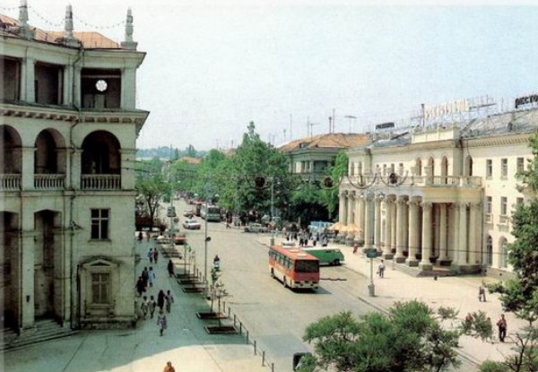
Soviet reconstruction of the city core included the renaming of streets (such as the main street, from Yekaterininskaia to Leninskaia, and next to the Saint Vladimir Cathedral, from Sobornaia [Cathedral] to Suvorov) and construction of some new buildings, monuments and playgrounds (rides and small zoological garden added in southeast corner of the ‘Historic Boulevard’). Of the sports facilities, the ‘Bicentennial of Sevastopol Stadium’ and sports complex which replaced the Chaika Stadium in 1983 are on the west side of this core, near the old city cemetery. To the south of the core, a large district of multi-story apartments straddles both sides of the new (1960s–70s) wide General Ostriakov Avenue, terminating near the south end with a shopping mall and a hospital. On the east side of the Southern Inlet (in the Nakhimov raion), in place of the admiralty is the Sevastopol Branch of the Moscow State University, south of it, in place of the barracks the training detachment of the Black Sea Fleet of the Russian Federation, and east of the latter, the ‘Stadium SKS Arena’ (home of the Sevastopol Football Club, opened in 1985, expanded in 2010 to be in the premier league of Ukraine). East of this is the Malakhov Kurhan Memorial Complex, and beyond that, the smaller ‘Metalist Stadium’, home of a regional football club. Southeast of the eastern core, three new (1960s–70s) wide avenues, spawned large apartment neighborhoods.
West of the old core is the Gagarin raion. Its shoreline extends from the breakwater that partly encloses the Sevastopol Bay and Karantynna bukhta (Quarantine Inlet) west through the shallow Pishchana bukhta (Sandy Bay), the long Striletska bukhta (Shooter’s Inlet), the Kruhla [aka Omega] bukhta (Round Bay), the long, deep Komyshova bukhta (Komyshova Inlet), and the Podviina bukhta (Double Inlet), comprising the larger Kozacha bukhta (Cossack Inlet) and its smaller western companion Solena bukhta (Salty Inlet), before reaching its end point at Cape Khersones.
The headland between Karantynna bukhta and Pishchana bukhta contains the ruins of Chersonese Taurica and southeast of it, its necropolis. West of Pishchana bukhta, overlooking the Striletska bukhta, is the campus of the Nakhimov Naval Academy with its sports facilities and south of it, the campus of the Sevastopol State University. Southwest of the ruins and southeast of the university are blocks of multi-story apartments (1960s) and south of Gagarin Avenue are the Gagarin Raion Court House and a market.
On the other side of Striletska bukhta, a branch of the Nakhimov Naval Academy was re-organized in 2009 into the Navy Lyceum of the Ministry of Defense of Ukraine, but after Russian occupation in 2014 converted into the Sevastopol Presidential Cadet School. West and inland from it is a huge Victory Park (with a waterpark in the north end and a north-south esplanade dominated by a high Saint George column near the southern entrance). West of the park, overlooking the Kruhla bukhta, is the helicopter repair plant. South of the park is a large neighborhood of high-rise apartments (1970s), known as Striletska bukhta, with their schools and shopping areas.
To the west, the headland between Kruhla bukhta and Abramovo Bay is named after Saint Andrew the Apostle and bears his marble statue; on its east side, facing Kruhla bukhta is the Military Medical Center; on the west side, overlooking Abramovo Bay, is a neighborhood of large villas and south of them, cottages for foreign guests with nearby helicopter pads. To the east stands the ‘Omega City’ commercial complex (2000s) and beyond it apartments and hotel overlooking Omega beach. To the west, at the south shore of Abramovo Bay is a cluster of beachfront apartments, and beyond them, on another headland, an abandoned military base that guarded the entrance to Komyshova bukhta. Inland to the south are clusters of high rise apartments with neighborhood schools and parks, collectively known as the Komyshova bukhta (1970s).
On the west side of Komyshova bukhta, the Sevastopol commercial port (built 1964–) handles, from north to south, containers, grain, and fish; at its south end is the ‘Yuzhnyi Sevastopol’ ship repair facility; on the western shore of Komyshova bukhta is the 2nd Sevastopol Petroleum Port. Both are served by railway spurs from the south, along which is a large residential area of homes with gardens.
At the westernmost twin inlet, aptly called Podviina bukhta, comprising the larger Kozacha bukhta and its smaller western companion Solena bukhta, at their southern ends, there are neighborhoods of apartments, a military base, and a yacht club. On the western shore of Podviina bukhta there is the natural preserve ‘Bukhta Kozacha’ that also houses a Military Dolfinarium where seals were trained to find mines. This westernmost headland of the Heracles Peninsula accommodates a Soviet ‘Dnepr’ early warning radar complex with a landing strip (used to monitor Turkish air space; it was de-commissioned by Ukraine but the Russian Federation plans to re-activate it).
On the north shore, the largest built-up area is directly across from the old core, connected to it by a ferry. Beginning in the 1830s, there were fortifications built to guard Sevastopol (Konstantine’s battery at the entrance to the bay, then eastward, Michael’s Battery and Battery No. 4, and high above, the Northern Fortification). By 1904 a settlement developed next to Battery No. 4. The 1960s–70s reconstruction of the north shore (‘Pivnichna storona’), serviced by roads and railway spurs, produced a mix of residential, institutional, and industrial land uses with single housing supplemented by clusters of high rise apartments and parks. On the northern outskirts, in the middle of a military cemetery, stands the pyramid-shaped Saint Nicholas’s Church. East of the north shore (in the ‘Holandiia’ neighborhood) is the Sevastopol Institute of Nuclear Energy and Industry and beyond it, a military storage area and a fuel depot for the Black Sea Fleet.
The railway line within Sevastopol has many branches that serve the shipping and industry needs. From Simferopol, the railway follows the Belbek River west to Povorotne village where it turns south towards Inkerman. At the settlement Mekenzievi Hory (Mackenzie Mountains), a branch proceeds southwest to the North Shore, where it services a naval engineering depot, the Marine Industrial Complex. From Mekenzievi Hory, the main line meanders south southeast to Inkerman, with spurs to navy docks and quarries. Beyond the junction at Chorna River, the main line turns west to follow the south shore to its terminus at the old Sevastopol railway station, along the way servicing the Sevastopol Thermal-Electric Power Plant and the ship-building and repair facilities. From the junction at Chorna River, the southern branch follows the Chorna River lowland towards Balaklava, with several branch lines: at Shturmove, to the southeast, the Chorna River branch, to a quarry (now both abandoned); at Pervomaika, the western branch, bypassing the Sevastopol built-up area to the Sevastopol commercial port at Komyshova bukhta; and south of Shturmove, the southern branch, past the Balaklava Thermal-Electric Power Plant to Balaklava, with a spur west to a flux limestone quarry west of Balaklava. The rails also provide for suburban train service to 7 stations.
City transport is provided by bus (101 lines), trolley bus (14 lines), minibus (52 lines), express bus (15 lines), bay cutter (6 lines), bay ferry (1 line), and suburban train (1 route). Streetcars operated from 1898 (with inter-city Sevastopol–Balaklava line added in 1925) but were replaced by trolley buses after the Second World War. The Belbek Air Force Base also serves as the city airport.
The port is one of the finest natural ports on the Black Sea and can accommodate the largest ships. As a commercial port in the Crimea it is second only to Teodosiia.
BIBLIOGRAPHY
‘Sevastopol'’ in Heohrafichna entsyklopediia Ukraïny (Kyiv 1993)
Vermenych, Ia.; Vortman, D. ‘Sevastopol'’ in Entsyklopediia istorii Ukraïny, vol 9 (Kyiv 2012)
‘Karta Sevastopolia’ in Mapa Ukraïny https://kartaukrainy.com.ua/Sevastopol
Ihor Stebelsky
[This article was updated in 2022.]

.jpg)
%20monument.jpg)
.jpg)
.jpg)
