Ivano-Frankivsk oblast
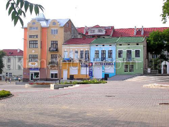
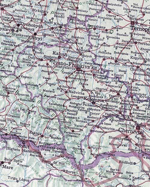
Ivano-Frankivsk oblast [Івано-Франківська область; Ivano-Frankivs'ka oblast']. An administrative region in Western Ukraine, established on 4 December 1939. Until 1962 it was called Stanyslaviv oblast. With an area of 13,900 sq km and population of 1,377,500 (2018), the oblast has 14 raions, 15 cities, 24 towns (smt) and 765 villages. Its capital is Ivano-Frankivsk (formerly Stanyslaviv).
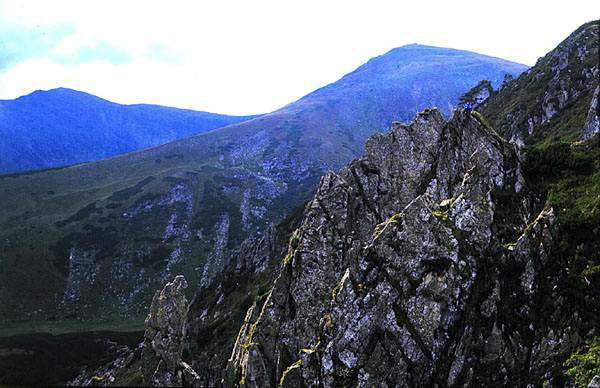
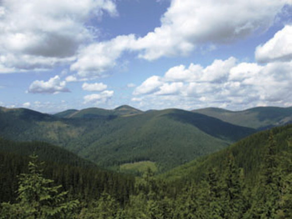
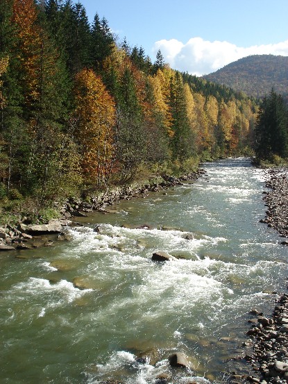
Physical geography. The Carpathian Mountains in the west and southeast cover nearly one-half of the oblast’s territory. The highest ranges are the Gorgany Mountains (with a maximum elevation of over 1,800 m) and Chornohora (reaching 2,000 m). The middle part of the oblast, stretching from the Carpathian Mountains to the Dnister River valley, lies in the Dnister Lowland. The land rises again to the north of the Dnister River as part of the Opilia Upland and to the southeast as the Pokutian-Bessarabian Upland. In the north the soil is mostly degraded chernozem, gray forest podzol, and deep chernozem; in Subcarpathia it is primarily clay or peat podzolic; in the Carpathians, brown soils and mountain meadow soils predominate; and in the river valleys, meadow and bog soils are common. Forests (mainly beech, fir, and pine in the mountains and oak, maple, and ash in the lowlands) cover 35 percent of the oblast’s territory. The rich mineral resources of the oblast include oil (see Petroleum deposits), natural gas, potassium salts, common salts, ozokerite, brown coal, bituminous shales, phosphorite, marl, limestone, graphite, and mineral water springs. The principal rivers are the Dnister—with its tributaries the Bystrytsia River, Limnytsia River, and Svirzh River (on the right bank) and the Hnyla Lypa River and Svicha River (on the left bank)-and the Prut River with its tributaries the Licha River, Rybnytsia River, and Cheremosh River. The climate of the oblast is temperate-continental: temperatures average –5.1°C in January and 18.8°C in July. Temperatures are one or two degrees lower in the mountains. The annual precipitation is 500–800 mm (800–1,100 mm in the mountains), and the growing season lasts 150–165 days a year.
History. Until the 12th century, the territories of the present oblast formed part of the Kyiv principality. From the middle of the 12th century, these territories were successively part of the Halych principality, the Volodymyr principality, and the Principality of Galicia-Volhynia. In the 14th century they came under Lithuanian and then Polish rule as part of the Polish-Lithuanian Commonwealth. The area was acquired by Austria in the 18th-century Polish partitions. A part of the Western Ukrainian National Republic following the First World War, the territories then came under Polish rule after the defeat of the former, as part of Stanyslaviv county. They were annexed by the USSR in 1939 as Stanyslaviv oblast. Soviet rule was re-established in 1944 and independent Ukraine in 1991.
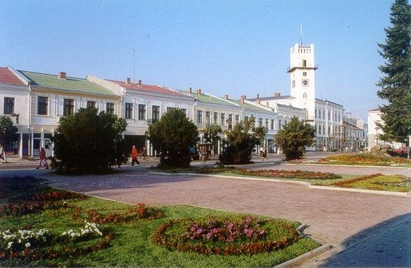
Population. With some of the highest rural population densities, Ivano-Frankivsk oblast has an average population density of 99.1 people per sq km (2018), the fifth highest among the oblasts of Ukraine. Its proportion of the urban population rose from 22.8 percent of the total population in 1959 to 30.8 percent in 1970, 42.4 percent in 1990, settled at 42.0 percent in 2001 and then rose to 44.0 percent by 2018. The total population of the oblast grew from 1,094,639 in 1959 to 1,442,719 in 1994 after which it began to decline. Contributing factors were a decrease in birth rates, a rise in death rates (which exceeded birth rates by 1997) and emigration. After Ternopil oblast, Ivano-Frankivsk oblast is the second most ethnically homogeneous region in Ukraine. The three largest ethnic groups of the population in 2001 (1959 and 1989 figures in parentheses) were: Ukrainians 97.5 (94.8, 95.0) percent, Russians 1.8 (3.5, 4.0) percent, and Poles 0.13 (1.0, 0.24) percent. In 2018, three cities had a population of over 50,000: Ivano-Frankivsk (235,000), Kalush (66,000), and Kolomyia (61,000). In 2017 the oblast had 20 professional-technical schools with 9,900 students and 16 postsecondary institutions with 37,100 students, including the Subcarpathian National University in Ivano-Frankivsk.
Economy. Ivano-Frankivsk oblast is an agrarian-industrial region. The major industries involve the processing of local petroleum deposits as well as mineral, forest, and agricultural resources. Most industrial development has occurred since the Second World War. In 1986, when services were not counted, industry contributed 73.8 percent of the oblast’s output by value and agriculture 26.2 percent. After 1991, as market economy developed, state enterprises restructured, private firms and services gained importance. By 2017 to the gross regional product of the oblast industry contributed 26 percent, trade 14 percent, agriculture 14 percent, financial services 8 percent, transport and communications 6 percent.
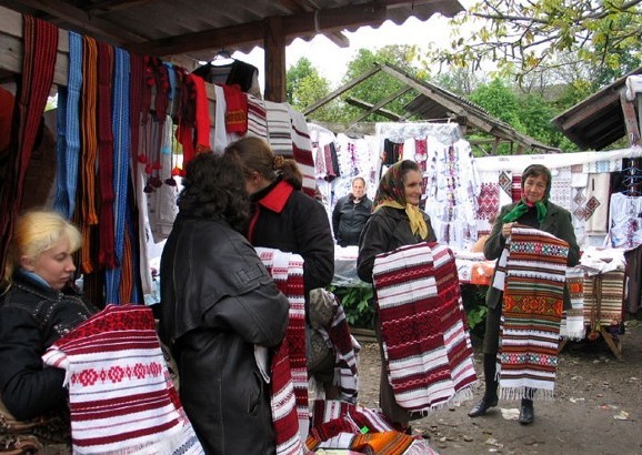
Industry. Industry in Ivano-Frankivsk is based mainly on local mineral, forest, and agricultural resources. It also utilizes the energy resources of the oblast: natural gas (13.7 percent of Ukraine’s output in 2009), petroleum deposits (17.5 percent), peat (7.1 percent), and electricity generated at the regional power plant in Burshtyn and thermal power plant in Kalush. In 1986 light industry accounted for 21.4 percent of the gross value of production in the oblast. This was followed by the fuel-energy complex (16.1 percent), machine building and metalworking (14.3 percent), the chemical industry (approximately 13.7 percent), the food industry (13.1 percent), and the forestry (including woodworking and furniture making) industry (12.5 percent). Other industries included the mining of potassium salts (Kalush accounting for 50 percent of the output in Ukraine), of stone, gravel and sand for construction, and the manufacture of construction components and materials. Petroleum and natural-gas production, important industries in the interwar period, have steadily declined in importance as resources have been depleted. Light industry in the oblast includes leather tanning and processing (in Ivano-Frankivsk and Bolekhiv), fur processing (Tysmenytsia), knitting (Ivano-Frankivsk), weaving and brush production (Kolomyia), and cottage industries such as wood carving, incrustation, carpet weaving, and embroidery (Ivano-Frankivsk, Kosiv, Kolomyia, Verkhovyna, Kuty). The machine building and metalworking industry, centered mainly in the city of Ivano-Frankivsk, specializes in the manufacture of control and regulatory apparatuses, agricultural machinery, mechanical presses, and electrotechnical and petroleum-industry machinery, and in the fitting and maintenance of locomotives. The chemical industry and petrochemical industry (in Ivano-Frankivsk, Nadvirna, Kalush, and Vyhoda) produce potassium derivatives, vinyl chlorides, aerosols, butane, propane, edible paraffin, carbamic and polychlorovinyl tars, and synthetic oils. Sugar refining is the most important branch of the food industry (in Horodenka and Bilshivtsi, formerly Bovshiv). It is followed by the dairy, meat, baking and distilling, brewing, tobacco-curing, canning, and confectionary industries (in Ivano-Frankivsk, Kolomyia, Kalush, and Sniatyn). The forestry industry is centered in Nadvirna, Bolekhiv, Verkhovyna, Broshniv-Osada, and Vyhoda; furniture manufacturing is based in Ivano-Frankivsk, Sniatyn, and Bolekhiv; and the paper industry is concentrated mainly in Kolomyia. Oil and gas are extracted in Dolyna, Nadvirna, Bytkiv, and Pasichna. In 1968 the oblast accounted for 9.7 billion cubic meters or 19 percent of all the gas extracted in the Ukrainian Soviet Socialist Republic and supplied gas to Kyiv and Moscow. By 2017 its output declined to 0.4 billion cubic meters or 2 percent of Ukraine’s output.
Agriculture. Both crop cultivation and animal husbandry are practiced in Ivano-Frankivsk oblast. Since 1991, collective farms and state farms were replaced by commercial family farms, various forms of farming associations and corporate farms. Thus, while in 1983 in Ivano-Frankivsk oblast there were 168 collective farms (252 in 1971) and 30 state farms (20 in 1971), by 2009 there were 550 commercial family farms, 87 farm corporations, 82 farm enterprises, 26 farm co-operatives, 3 state farms, and 27 other farming enterprises. The total arable land in the oblast has declined from 609,000 ha in 1989 to about 491,000 in 2007. Specific uses of farmland also declined, but the share of cultivated land increased to 73.6 percent. In 1989 68.9 percent of the arable land was cultivated, while 16.4 percent was in pasture and 12.3 percent in hayfields, mostly on slopes of hills and mountains, and 2.4 percent used for other purposes. The total seeded area also declined and the crop mix changed to more intensive food crop production. In 1978, of the total seeded area of 430,000 ha, 176,300 ha (41 percent) was devoted to grain crops, 149,600 ha (34.8 percent) to fodder, 57,200 ha (13.3 percent) to potatoes and vegetables, and 46,900 ha (10.9 percent) to industrial crops. By 2007 the seeded area declined to 295,000 ha, of which 112,800 ha (38.2 percent) was in grain crops, 100,000 ha (33.9 percent) in fodder, 70,100 ha (23.8 percent) in potatoes and vegetables, and 12,100 ha (4.1 percent) in industrial crops. The principal grains are winter wheat (79,900 ha in 1978, declining to 76,200 ha in 1990 and 44,100 ha in 2007) and barley (respectively 50,000 ha, 36,800 ha and 23,900 ha). Corn gained significance (8,000 ha in 1990 and 24,200 ha in 2007). Sugar beets account for about one-half of the total area devoted to industrial crops; other industrial crops grown in the oblast included flax and tobacco, now largely replaced by rape (5,300 ha in 2007) and sunflower (300 ha). Orchards and berry patches covered 24,100 ha in 1978, declining to 15,600 in 1990 and 8,500 in 2007; the principal fruits harvested are apples, pears, plums, and cherries. Walnuts are also grown. Animal husbandry is well developed in the oblast, particularly in the hilly and mountainous regions. It consists mainly of dairy-and beef-cattle farming. In 2007 (in brackets 1972) there were some 227,400 (533,400) head of cattle, including 140,700 (229,200) milk cows. The main breeds of cattle are the Simmental, Spotted Black, and Carpathian Brown. There were also some 182,300 (267,700) hogs in 2007 (the Large White, the Long-eared White, and the Myrhorod) and 116,300 sheep and goats. Poultry has increased from 2.5 million in 1975 to 4.8 million in 1990 and 5.8 million in 2007. Fishing is also practiced.
Transport. The oblast has 479 km of railways. The main railway junctions are Ivano-Frankivsk, Kolomyia, and Deliatyn. The main lines are those from Lviv to Ivano-Frankivsk and from Ivano-Frankivsk to Kolomyia, Kalush, and Deliatyn. There are some 5,800 km of motor roads, 4,400 km of which are hard surfaced. Highways link Ivano-Frankivsk with Lviv, Kolomyia–Chernivtsi, Deliatyn–Rakhiv, Stryi–Mukachevo–Uzhhorod, and trunk roads to Kolomyia–Kosiv–Verkhovyna. There is also an airport in Ivano-Frankivsk. Two Soviet era pipelines for gas export pass through the oblast: the Soiuz gas pipeline from Orenburg and the Braterstvo (Brotherhood) gas pipeline from Urengoy, meeting at Bohorodchany on way to Uzhhorod.
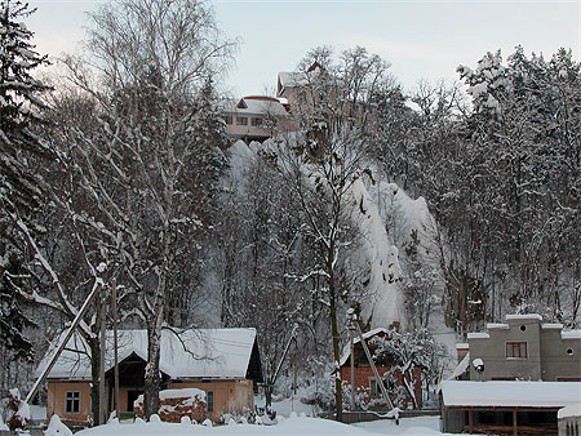
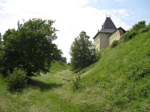
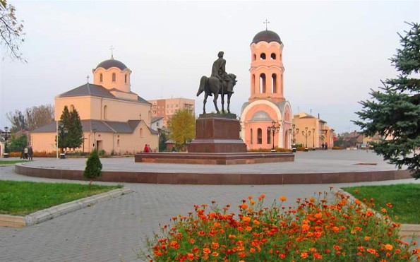
Tourism. After Kyiv and Lviv, tourism in Ivano-Frankivsk oblast ranks third in Ukraine. The oblast is well endowed with natural and cultural resources. Among its natural attractions are the Carpathian National Nature Park (est. 1980, 47,300 ha), the Hutsulshchyna National Nature Park (est. 2002, 32,300 ha), the Halych National Nature Park (est. 2004, 14,700 ha), the Syniohora National Nature Park (est. 2009, 10,900 ha), the Verkhovyna National Nature Park (est. 2010, 12,000 ha), 11 natural preserves, 13 natural monuments, 3 dendrological parks and 7 botanical gardens. Resorts feature Hutsul folk culture in its mountain environment (Kosiv, Kremintsi, Sheshoty, Vorokhta, Yaremche) or mineral waters and mud baths. There are cultural attractions (museums, theaters, folk festivals) and many historic sites (in Halych and nearby Krylos, Ivano-Frankivsk, Kolomyia, and many others). In 2017 the oblast accommodated 340,700 tourists (of whom 18,400 were foreign guests) registered in 274 hotels and tourist resorts.
BIBLIOGRAPHY
Pro sotsialistychni peretvorennia na Stanislavshchyni (Stanyslaviv 1957)
Rozkvit ekonomiky zakhidnykh oblastei URSR (1939-1964rr.) (Lviv 1964)
Istoriia mist i sil Ukraïns'koï RSR: Ivano-Frankivs'ka oblast' (Kyiv 1971)
Koval'chak, H. (ed). Industrial'nyi rozvytok zakhidnykhoblastei Ukraïny v period komunistychnoho budivnytstva (Kyiv 1973)
Pryroda Ivano-Frankivs'koï oblasti (Lviv 1973)
Sotsial'ni peretvorennia u radians'komu seli: Na prykladi silzakhidnykh oblastei Ukraïns'koï RSR (Kyiv 1976)
Atlas Ivano-Frankovskoi oblasti ( Moscow 1990)
“Ivano-Frankivska oblast'” Heohrafichna entsyklopediia Ukrainy, vol. 2 (Kyiv 1990)
Ivano-Frankivshchyna – krai turyzmu (Lviv 2009)
“Ivano-Frankivska oblast'” Statystychnyi atlas Ukrainy (Kyiv 2017) http://www.ukrstat.gov.ua/
Boris Balan, Ivan Myhul, Ihor Stebelsky
[This article was updated in 2019.]

.jpg)
.jpg)
.jpg)
.jpg)
