Mariupol
Mariupol or Mariiupil [Маріуполь; Mariupol' or Маріюпіль; Marijupil']. See Google Map; see EU map: VI-18. A port city (2020 pop 437,000) on the Sea of Azov at the mouth of the Kalmiius River in Donetsk oblast. A major industrial center, it is the tenth-largest city in Ukraine. From 1948 to 1989 it was called Zhdanov. Following the launch of a full-scale invasion of Ukraine by the Russian Federation in February 2022, Mariupol became the target of extremely intense shelling and bombardment by the Russian aviation and artillery. Indiscriminately targeting civilian buildings and infrastructure of the city, the Russian Army virtually destroyed the city and created in it a dreadful humanitarian catastrophe.
History. Mariupol’s origins date back to the beginning of the 16th century, when the Cossack fortress of Domakha, on the site of the former Venetian-Genoese colony, Adomakha, was built. By 1611 Domakha was the center of the Zaporozhian Cossack Kalmiius Palanka. In 1734 the fortress spawned Kalmiius, a larger adjoining settlement where the Church of Saint Nicholas was built (1754; the remains of its stonework may be seen on the high right bank of the Kalmiius River northeast of Liberation Square). In their campaign in 1768, the Crimean Tatars took the fort and settlement. When Russia annexed the territory in 1775, making it part of Azov gubernia, the fortress and settlement with its church were re-built by the Zaporozhian Cossacks (who were then removed to the Vovcha River in 1778), and renamed Pavlovsk. In place of the Cossacks, Orthodox Greeks from the Crimea (some spoke Pontic Greek, while others spoke Turkish—the language of the bazaar—or Crimean Tatar) were resettled there and in its vicinity. The Greeks gave their villages names of places from where they had come in the Crimea (like Manhush, Sartana, Staryi Krym, and Yalta) and inaugurated the Cossack-built Greek church. In 1780, Pavlovsk was renamed Mariupol (Mariiupil, Marianopol). Fishing, fish processing, and trade grew in importance.
In the late 19th century Mariupol was developed as a shipping port for the Donets Basin. In 1882 it was linked with Donetsk by railway, and in 1886–9 the commercial port was built. The main exports were coal and grain. By 1900 the port was handling 1 million t of freight, and the tonnage doubled in the next decade. At the turn of the century a tube-rolling and two metallurgical plants were built (the Nikopol, in 1897 by the American businessmen Rothstein and Smith, and the Russian Providence, in 1899 by a Belgian company). Easy access to raw materials, labor, and a port for export were the main attractions. From that time the town's heavy industry grew rapidly.
From 1892 to 1897 the population of Mariupol almost doubled, from 17,000 to 31,100. By native tongue in 1897, the majority (63 percent) was Russian-speaking, followed by Yiddish (15 percent), Ukrainian (10 percent), Greek (5 percent), Turkish (3 percent) and Tatar (1 percent). By the beginning of the First World War the city’s population had jumped to 54,000. The Revolution of 1917 and civil war reduced it to 30,000 by 1921. Having recovered to 41,300 by 1926, the city’s population also became more diverse, comprising by ethnicity 35.2 percent Russian, 32.9 percent Ukrainian, 17.8 percent Jewish, and 10.1 percent Greek. The Soviet government designated two administrative raions around Mariupol, Manhush and Sartana, as those of Greek nationality (1926–32) and provided schooling in the Greek language there and in the city. The Ukrainian language was also allowed until 1934, with the establishment in 1923 of the literary union, ‘Dzvony Azovia’ (Bells of the Oziv Region), the opening up of Ukrainian-language schools and the newspaper, Illichivets' (1929).
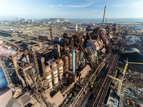
In 1919 the two steel plants were combined into one, and in 1924 the Bolsheviks named it Illich, after Vladimir Lenin. In the late 1920s the port was expanded to handle the Donets Basin’s increased output, and the Mariupol Azovstal Metallurgical Plant, one of the largest in the Union of Soviet Socialist Republics, was built (1933) on the left bank of the Kalmiius River with its own port to handle iron ore from the Kerch Peninsula of the Crimea. Mariupol became, after the Donets Basin and the Dnipro Industrial Region, the third-largest center of heavy industry in Ukraine. It attracted many workers and also served the Ukrainian peasants as a point of refuge from the Famine-Genocide of 1932–3. By 1939 the city’s population had reached 227,000. The city was heavily damaged during the Second World War, and its population fell to 85,000 in 1943.
Postwar reconstruction and industrial expansion brought rapid growth to the city: from 283,600 in 1959 to 502,600 in 1979, peaking at 529,000 in 1987. Subsequent economic decline and ageing population brought about an accelerating population decline: 520,700 in 1994, 492,200 in 2001, 477,600 in 2007, 458,500 in 2014, and 437,000 in 2020. Following Ukraine’s independence, there was religious and national revival, privatization of industries and their renewal, with some inflow of Ukrainians from western Ukraine for work. The ethnic composition of the city (in 2001) shifted in favor of Ukrainians (48.7 percent) over Russians (44.4 percent), while Greeks continued to decline to 4.3 percent and Jews to sixth place at 0.2 percent, mainly from assimilation and emigration.
On April 13, 2014, pro-Russian separatists seized control of Mariupol to make it part of their so-called ‘Donetsk People’s Republic.’ After heavy fighting, Mariupol was liberated by Ukrainian volunteer battalions (notably the Azov Battalion) on June 13, 2014. It became the seat of the Donetsk Oblast Administration, evacuated from Donetsk, but the nearby front and a terrorist attack compelled the oblast administration to relocate to the more secure Kramatorsk. Mariupol also underwent a significant de-Communization of place and street names in 2016. During the full-scale invasion of Ukraine by the Russian Federation in 2022, Mariupol became one of the key battlegrounds of the war. The city was blockaded by the Russian Army, and the extremely intense shelling and bombardment of civilian buildings and infrastructure by the Russian aviation and artillery resulted in numerous civilian deaths, massive destruction, and a colossal humanitarian catastrophe. In spite of that, the Russian Army was unable to capture the city for a several months and Mariupol remained under control of the Armed Forces of Ukraine until 16 May 2022.
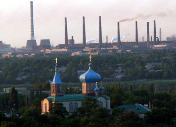
Economy. Mariupol is the largest industrial producer, by value, in Donetsk oblast, surpassing that of its largest city, Donetsk. In 2014 ferrous metallurgy and metal products made up 78.3 percent of the city’s industrial production, by value; machine-building was second, with 14.2 percent. Its two ferrous metallurgy combines in 2003 accounted for 70.3 percent of the cast iron and 70.4 percent of the steel produced in Donetsk oblast. The Illich Mariupol Metallurgical Combine (a privatized shareholding company since 2000) is the second largest, after Mittal Steel Kryvyi Rih (formerly Kryvorizhstal), in Ukraine. In 2005 it employed up to 95,000 workers in its steel plant and 52 subsidiary operations, including former state farms, and produced 6 million t of cast iron, 7 million t of steel, 5.3 million t of cold and hot rolled steel, and 13.5 million t of sintered steel, much of it for export. The second, the Mariupol Azovstal Metallurgical Complex (privatized by Metinvest, part of Rinat Akhmetov’s Systems Capital Management), is the third largest in Ukraine. In 2008 it acquired the adjacent coke refinery. It also produced a full range of products, including 6 million t of cast iron, 7 million t of steel, 4.5 million t of rolled steel with unique properties, and 1.5 million t of sintered steel. Its steel products are used for such demanding applications as ship-building, bridges, pipelines in harsh climates, and tank armour. A third smaller plant with an electric furnace, Azovelektrostal, was declared bankrupt in 2016. There were two machine-building plants: the Mariupol Heavy-Machine-Building Plant (making metallurgical, shipbuilding, and mining equipment, port cranes, and railway tanker cars), and the ‘Mariupol Thermite Plant’ (coating and fabrication of metals), now combined into the ‘Azovmashprom’ consortium. In addition, Mariupol has a ship repair operation, an electric equipment plant, a medical equipment plant, a farm equipment parts plant, an engine radiator plant, a graphite plant, and a brick-making plant. Construction industry is important. The food industry is represented by grist milling, baking, confectionery, dairy, meat, and fish processing. The light industry included hosiery and clothing, but this declined after 1991 because of import competition.
Mariupol was well served by rail, road, and air. Since the outbreak of hostilities in 2014, however, the connections through Donetsk (both rail and road) and by highway east to the occupied Novoazovsk and to the Russian Federation have been severed by an active front. The Mariupol International Airport, being within 30 km of the front, was also closed to air traffic.
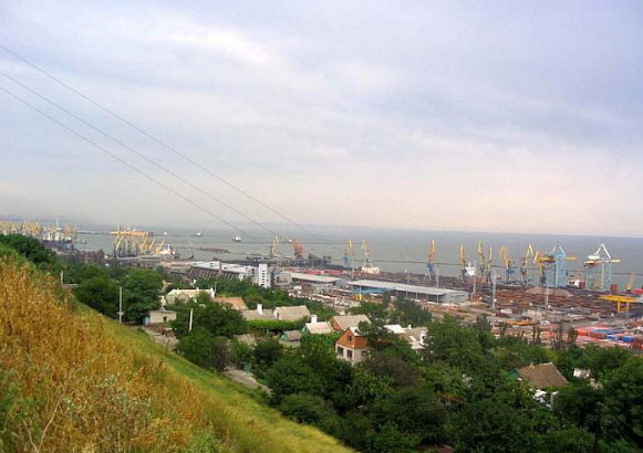
After Odesa, Mariupol is the second largest seaport in Ukraine. The use of icebreakers enables it to remain open year-round. Known as ‘the ocean gateway of the Donbas,’ Mariupol is used by Ukraine to export metals, grain, salt, and machines and to receive domestic iron ore, manganese ore, and cement. In the Soviet period, its importance as a shipping outlet increased with the completion of the Volga–Don Canal, which linked the Sea of Azov with Moscow and the Caspian Sea. Russia’s annexation of the Crimea in 2014, the construction of the Kerch Strait Bridge, and hostilities in the Sea of Azov, however, have reduced shipping to and from Mariupol.
After the Second World War the seacoast near Mariupol was developed into a health resort area specializing in climatological and mud therapy. The resort industry has declined, especially since 2014, but beaches are popular, especially among the local population.
After Kryvyi Rih, Mariupol has the second highest air pollution among the cities of Ukraine. In the past 15 years, through special effort, industrial emissions have been cut in half. The city’s heavy industry remains a major contributor to the pollution of the Sea of Azov.
Culture. In 1991 Mariupol was mostly a Russian-speaking city with Russian language education. Since Ukraine’s independence 12 out of its 72 schools (by 2005) were converted to teaching in the Ukrainian language. Mariupol also had a revival of religious worship after its destruction in the 1930s with the building of new churches and houses of worship. In 2020 there were 11 Orthodox churches (7 of the Moscow Patriarchate and 4 of the Orthodox Church of Ukraine), 4 protestant houses of worship, and one mosque.
Mariupol also became a significant center of learning and culture. It has two universities, two academies, three institutes, six technical colleges, four other colleges, and three post-secondary special training schools. The Azov State Technical University began as a training school for the workers of Illich Iron and Steel Works in 1930; it became the Mariupol Metallurgical Institute in 1933, and gained a university status, its current name, and a program in Ukrainian studies in 1993. The Mariupol State University began with the initiative of the Hellenic Association of Mariupol in 1991 and support from the government of Greece (through its consulate in Mariupol) as the Mariupol College of Humanities affiliated with the Donetsk University; in 2004 it was elevated to Mariupol State University of Humanities when it established the Faculty of Greek Philology and Translation, and the Faculty of Philology and Mass Communications with the Department of Ukrainian Philology; in 2010 it acquired the status of a classical university with its current name. The academies in Mariupol are: the Azov Branch of the Academy of Economics and Business and the Mariupol Branch of the Interregional Academy of Personnel Management. The three institutes are: the Azov Institute of Marine Transport, the Institute of State and Law, and the Institute of Information Technologies. Special training schools are in medicine, music, and law enforcement. Since the 2014 hostilities began, Mariupol became a refuge for branches of the Donetsk National University, the Donetsk National Medical University, the Donetsk National University of Economics and Trade, and the Donetsk State University of Management.
Mariupol houses the Donetsk Oblast Academic Drama Theater (formerly, the Oblast Russian Drama Theater), a puppet theater (established in 1999), and a variety of museums: the Mariupol Regional Museum of Natural History (established in 1920), the Azov Regional Ethnographic Museum, and the Arkhyp Kuindzhi Art Exhibition Hall, as well as museums of the Sea of Azov, of the Mariupol commercial port, and of industrial histories of the Illich factory and the Mariupol Azovstal Metallurgical Complex. The city is endowed with 17 public libraries. The literary association Azovia includes authors writing in Greek, Russian, and Ukrainian. The media is represented by a score of local newspapers, mostly in Russian; the main newspaper, Priazovskii rabochii, (est. 1918, was published in Ukrainian only from 1932 until 1934 as Pryozivs'kyi proletar) is now owned by System Capital Management; there are four television companies and seven radio stations.
Mariupol has well developed sports facilities. It has five stadiums: the Volodymyr Boyko Stadium, home of the Mariupol Football Club, the Illichivets Stadium, home of the former Illichivets Mariupol (in Ukrainian Premier League), the Azovstal Stadium (formerly Locomotive Stadium), home of the Azovets (later re-named Metalurh) Footbal Club (in Ukrainian First League, 1992), the Western Stadium, opened in 2005, home of the Yarud Football Club (Ukrainian Second League, 2020), and Portovyk Stadium, home of the Portovyk Football Club (Ukrainian Second League, 2001); and four sports complexes: the ‘Azovstal,’ the ‘Azovmash,’ the ‘Sadko,’ and the ‘Vodnyk.’ The multi-use Neptune Water Sports Complex, built in 1970 was repaired in 2008, and is now being re-built in 2020. Mariupol also has the Azovstal Yacht Club.
City plan. Greater Mariupol (aka Mariupol Council), with a population 457,400 (2020), is divided into four administrative sections (city raions): Central, Kalmiius, Left Bank (until 2016, the raions were called Illich, October, and Ordzhonikidze, respectively) and Seaside. On a map, it forms an irregular shape with two protrusions: to the northwest (the town of Staryi Krym, population 5,900) and to the northeast (the towns of Sartana, population 10,200 and Talakivka, population 3,900), all part of the Kalmiius raion); maximum dimensions are about 30 km from east to west and 22 km from north to south, covering an area of 244 sq km. The city of Mariupol is more compact, triangular in shape, with a base (18 km) along the coast and the apex in the north (the Illich Mariupol Metallurgical Combine in the Kalmiius raion) (11 km), forming an area of 106 sq km. Parks and gardens occupy 80.6 sq km.
The north-south alignment of Mariupol is defined by the Donetsk–Mariupol double-tracked electrified railway trunk line. Following the right bank of the Kalmiius River to its mouth, it forms the eastern frame of the central part of Mariupol. The passenger terminal is on the southern (coastal) side of Mariupol, but freight trains continue westward along the coast to the Mariupol Commercial Port. The northern limit of central Mariupol is defined by the Kalchyk River, the last right bank tributary of the Kalmiius River. In the west, the old center blends into newer neighbourhoods of apartment blocks, parks and institutions.
In the 19th century Mariupol comprised predominantly of single storey houses; only 34 were two-storey and 3 were three-storey brick buildings. Bell towers and domes of churches rose prominently above the civil structures. The steel mills were on the northern outskirts of the city, its workers housed in adjacent settlements. The railway terminal and port were on the coast.
Soviet reconstruction in the 1930s transformed the city. It implanted the Azovstal giant to face the downtown across the mouth of Kalmiius River and developed residential quarters east of it. It levelled all churches and replaced them with large buildings. It renamed streets, built broad boulevards and established new districts with tall apartment buildings and facilities for sports and recreation. With Ukraine’s independence new churches and other places of worship were built. Modern stores and shopping malls were added.
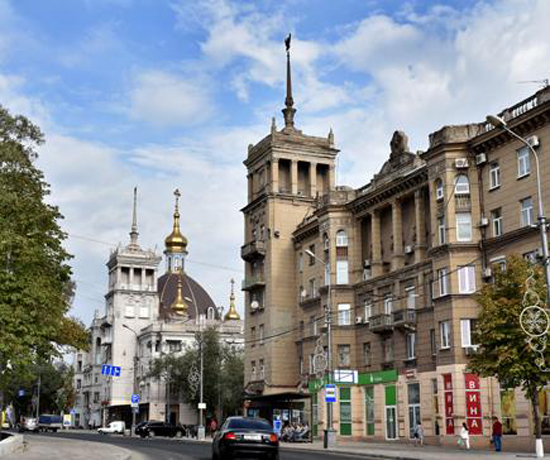
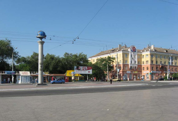
The Central raion retained its old grid street pattern. Its main east-west artery, leading west to the coastal highway to Kherson (with a branch to Mariupol International Airport) was widened and re-named from Catherine II Street to Vladimir Lenin Avenue and then, in 2016, to Peace Avenue. Along it are important symbolic features and institutional buildings. Its eastern anchor, the Kharlampiiev Cathedral (built in 1833–45) overlooking the Kalmiius River and fishing wharf, was levelled in the 1930s and replaced with administration buildings. Next to it is a small park, called Liberation Square (with a recent monument celebrating 500th anniversary of the Zaporozhian Cossacks) was the site of the original Kharlampiiev Church (popularly known as the Greek church, built by the Cossacks, inaugurated by the Greeks in 1780, re-named Saint Catherine’s Church when the cathedral next door was built, then levelled in the 1930s). 1 km to the west, a park-like Theater Square roundabout features the Donetsk Oblast Academic Drama Theater. It was built in 1960 on the site of Saint Mary Magdalene Church. As a replacement, in 2020, just north of this square, the Church of the Intercession of the Mother of God was built. One-half km farther west, at the city’s main intersection of the Metallurgists’ Avenue, on the southwest corner is the Mariupol City Hall. It is located within Greek Sqare, a park with a fountain. South of the city hall, across University Street, is the Azov State Technical University, and south of its campus, a palace of culture and the university’s sports complex and the Azovets Stadium. South of this, along the Metallurgists’ Avenue, is the city’s creative arts center, and beyond it, a large city park. Back to Peace Avenue, farther west on its south side, is a medical campus with a children’s hospital, and then, on the north side, the Freedom Square where a Lenin monument was replaced with one to Prince Sviatoslav I Ihorovych (the Brave); north of this park and on the east side of the Builders’ Avenue is the Greek Cultural Center ‘Meotida’ and the main campus of Mariupol State University, housing faculties of history, economics and law.
From Mariupol City Hall, the Nakhimov Avenue leads southwest into the Seaside raion. Along this route, on the south side, are the Illichivets Sports Complex with its covered stadium, across from it the Warrior-Liberators Square (formerly the Communist Youth Square), then on the south side the extensive Seaside Park with an esplanade to a view of the sea past a coast guard cutter, and west of it a playground, tennis courts, a section with art sculptures, and farther into the park and overlooking the sea, the Sultan Suleiman Mosque and Saint Nicholas’s Church, and beyond them, the Park Hotel, the Illich Sanatorium, and a tuberculosis sanatorium for children. Near the end of Nakhimov Avenue is the Petro Mohyla Ukrainian Orthodox Church, and beyond, next to the port, is the Portovyk Stadium. Along the coast, between the commercial port and the passenger railway terminal is the Azovstal Yacht Club.
The western and northern frames of the city center are defined by two major thoroughfares. The Metallurgists’ Avenue (which follows the western wall of the city planned in 1787) sets the western frame. It proceeds north, past the Central Market, towards the Kalmiius raion and its Illich Mariupol Metallurgical Combine, leading on to the highway to Donetsk. The northern frame of the city center is defined by the Shevchenko Boulevard. To the west it leads to the highway through Volodarske to Zaporizhia. To the east, it leads across the Kalmiius River, past the Mariupol Azovstal Metallurgical Complex, through the Left Bank raion to the coastal highway, blocked at the front just beyond Shyrokyne.
A number of features are found beyond the city center or the port. In the Kalmiius raion along the Kalchyk River and west of Metallurgists’ Avenue are a park, a zoo and an amusement park with daring rides. Farther north, along the Kalchyk River and across Karpov Avenue from the Illich Mariupol Metallurgical Combine, is the V. Boiko Stadium, the Azovmash Sports Complex and the wooded Petrovsky Park with its band shell.
In the Left Bank raion, forming a buffer between the steel mill and the residential district, is a cemetery, the Leporsky Park (aka Azovstal Park) and the Azovstal Stadium. Beyond are other neighborhood parks and palaces of culture.
On the western periphery of the Central raion there are warehouses and two modern shopping malls: the Port City, at the western end of Shevchenko Boulevard, and the ‘Amstor’ mall on Peace Avenue. The Western Stadium is nestled in a green space among apartment buildings north of the western end of Shevchenko Boulevard.
Mariupol urban transport includes streetcars (12 routes), trolley buses (14 routes), and buses (mainly private minibuses).
BIBLIOGRAPHY
Pirko, V. ‘Naidavnishi mista Donechchyny (mify i realnist),’ Skhid (Donetsk), September 2004
Ihor Stebelsky
[This article was updated in 2022.]

.jpg)
.jpg)
.jpg)
.jpg)
.jpg)
.jpg)
.jpg)
.jpg)
